AAK Ala Archa, Kyrgyzstan - Earthquake Result Viewer
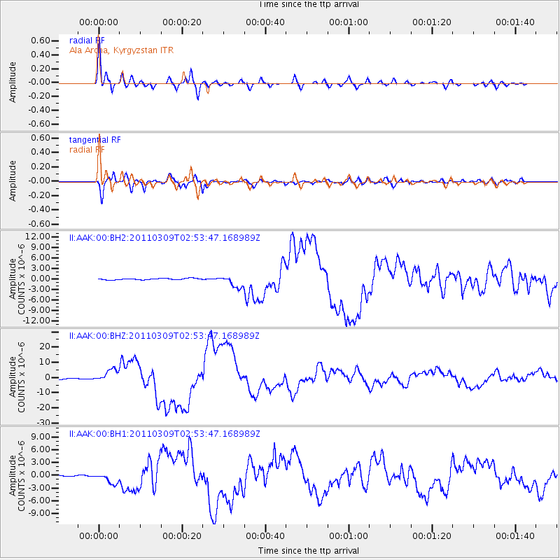
Earthquake location: Near East Coast Of Honshu, Japan
Earthquake latitude/longitude: 38.4/142.8
Earthquake time(UTC): 2011/03/09 (068) 02:45:20 GMT
Earthquake Depth: 32 km
Earthquake Magnitude: 6.4 MB, 7.3 MS, 7.5 MW, 7.3 MW
Earthquake Catalog/Contributor: WHDF/NEIC
Network: II Global Seismograph Network (GSN - IRIS/IDA)
Station: AAK Ala Archa, Kyrgyzstan
Lat/Lon: 42.64 N/74.49 E
Elevation: 1645 m
Distance: 50.8 deg
Az: 297.793 deg
Baz: 70.308 deg
Ray Param: 0.067736715
Estimated Moho Depth: 53.5 km
Estimated Crust Vp/Vs: 1.62
Assumed Crust Vp: 6.306 km/s
Estimated Crust Vs: 3.899 km/s
Estimated Crust Poisson's Ratio: 0.19
Radial Match: 97.200615 %
Radial Bump: 400
Transverse Match: 90.93478 %
Transverse Bump: 400
SOD ConfigId: 558545
Insert Time: 2013-09-18 10:24:50.760 +0000
GWidth: 2.5
Max Bumps: 400
Tol: 0.001

Signal To Noise

ChannelStoNSTALTA
II:AAK:00:BHZ:20110309T02:53:47.168989Z12.1597724.234154E-63.4820997E-7
II:AAK:00:BH1:20110309T02:53:47.168989Z6.01583961.3103019E-62.1780863E-7
II:AAK:00:BH2:20110309T02:53:47.168989Z8.981741.7657819E-61.9659686E-7
Arrivals
Ps5.6 SECOND
PpPs21 SECOND
PsPs/PpSs26 SECOND