HNR Honiara, Solomon Islands - Earthquake Result Viewer
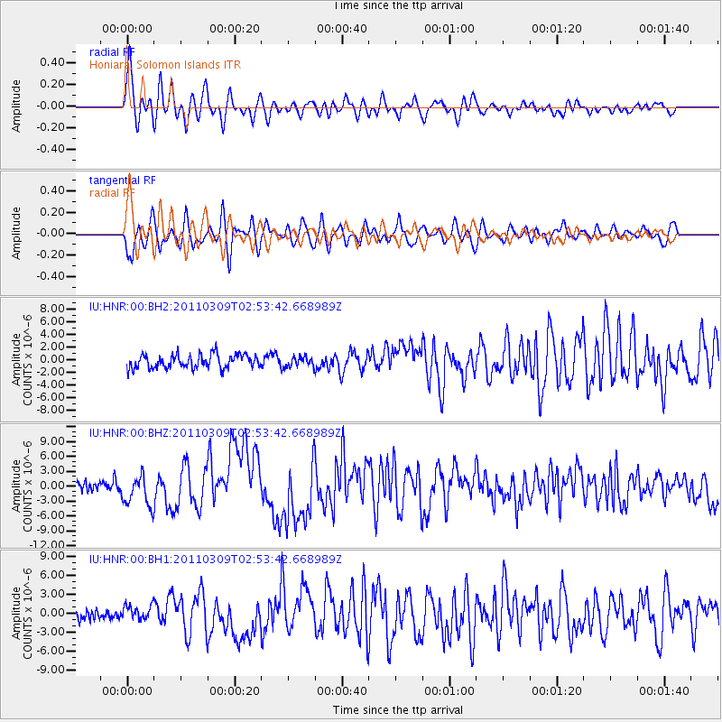
Earthquake location: Near East Coast Of Honshu, Japan
Earthquake latitude/longitude: 38.4/142.8
Earthquake time(UTC): 2011/03/09 (068) 02:45:20 GMT
Earthquake Depth: 32 km
Earthquake Magnitude: 6.4 MB, 7.3 MS, 7.5 MW, 7.3 MW
Earthquake Catalog/Contributor: WHDF/NEIC
Network: IU Global Seismograph Network (GSN - IRIS/USGS)
Station: HNR Honiara, Solomon Islands
Lat/Lon: 9.44 S/159.95 E
Elevation: 100 m
Distance: 50.2 deg
Az: 157.817 deg
Baz: 342.51 deg
Ray Param: 0.068135224
Estimated Moho Depth: 18.5 km
Estimated Crust Vp/Vs: 1.90
Assumed Crust Vp: 6.183 km/s
Estimated Crust Vs: 3.258 km/s
Estimated Crust Poisson's Ratio: 0.31
Radial Match: 81.90282 %
Radial Bump: 400
Transverse Match: 74.98217 %
Transverse Bump: 400
SOD ConfigId: 558545
Insert Time: 2013-09-18 10:25:29.417 +0000
GWidth: 2.5
Max Bumps: 400
Tol: 0.001

Signal To Noise

ChannelStoNSTALTA
IU:HNR:00:BHZ:20110309T02:53:42.668989Z2.82158833.2925266E-61.1669053E-6
IU:HNR:00:BH1:20110309T02:53:42.668989Z1.30096631.2182037E-69.363838E-7
IU:HNR:00:BH2:20110309T02:53:42.668989Z0.72750967.886401E-71.084027E-6
Arrivals
Ps2.8 SECOND
PpPs8.2 SECOND
PsPs/PpSs11 SECOND