You are here: Home > Network List > IU - Global Seismograph Network (GSN - IRIS/USGS) Stations List
> Station PMG Port Moresby, New Guinea > Earthquake Result Viewer
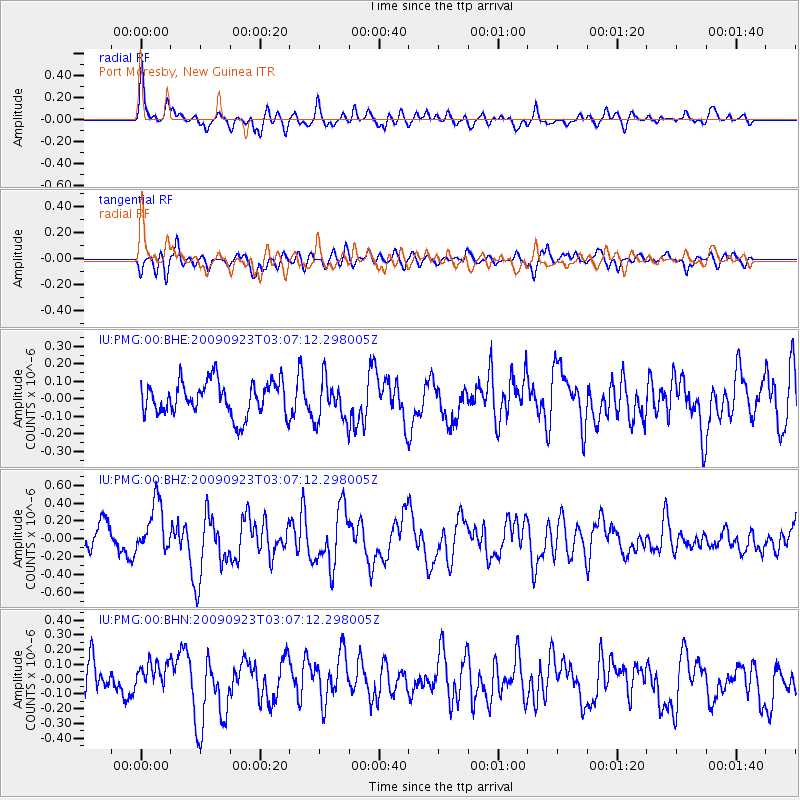
PMG Port Moresby, New Guinea - Earthquake Result Viewer
*The percent match for this event was below the threshold and hence no stack was calculated.
| Earthquake location: |
Macquarie Island Region |
| Earthquake latitude/longitude: |
-53.0/159.9 |
| Earthquake time(UTC): |
2009/09/23 (266) 02:59:30 GMT |
| Earthquake Depth: |
10 km |
| Earthquake Magnitude: |
6.0 MW, 5.4 MS, 5.3 MB, 6.0 MW |
| Earthquake Catalog/Contributor: |
WHDF/NEIC |
|
| Network: |
IU Global Seismograph Network (GSN - IRIS/USGS) |
| Station: |
PMG Port Moresby, New Guinea |
| Lat/Lon: |
9.40 S/147.16 E |
| Elevation: |
90 m |
|
| Distance: |
44.6 deg |
| Az: |
341.946 deg |
| Baz: |
169.048 deg |
| Ray Param: |
$rayparam |
*The percent match for this event was below the threshold and hence was not used in the summary stack. |
|
| Radial Match: |
67.48987 % |
| Radial Bump: |
400 |
| Transverse Match: |
63.10606 % |
| Transverse Bump: |
400 |
| SOD ConfigId: |
1 |
| Insert Time: |
2010-02-19 00:19:01.586 +0000 |
| GWidth: |
2.5 |
| Max Bumps: |
400 |
| Tol: |
0.001 |
|
Signal To Noise
| Channel | StoN | STA | LTA |
| IU:PMG:00:BHZ:20090923T03:07:12.298005Z | 2.0100355 | 2.8010803E-7 | 1.3935477E-7 |
| IU:PMG:00:BHN:20090923T03:07:12.298005Z | 0.9916068 | 9.794286E-8 | 9.877188E-8 |
| IU:PMG:00:BHE:20090923T03:07:12.298005Z | 1.222691 | 1.1832402E-7 | 9.6773434E-8 |
| Arrivals |
| Ps | |
| PpPs | |
| PsPs/PpSs | |


