You are here: Home > Network List > II - Global Seismograph Network (GSN - IRIS/IDA) Stations List
> Station WRAB Tennant Creek, NT, Australia > Earthquake Result Viewer
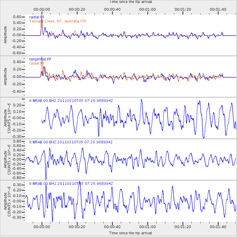
WRAB Tennant Creek, NT, Australia - Earthquake Result Viewer
*The percent match for this event was below the threshold and hence no stack was calculated.
| Earthquake location: |
Myanmar-China Border Region |
| Earthquake latitude/longitude: |
24.7/98.0 |
| Earthquake time(UTC): |
2011/03/10 (069) 04:58:13 GMT |
| Earthquake Depth: |
10 km |
| Earthquake Magnitude: |
5.5 MW |
| Earthquake Catalog/Contributor: |
NEIC PDE/NEIC PDE-M |
|
| Network: |
II Global Seismograph Network (GSN - IRIS/IDA) |
| Station: |
WRAB Tennant Creek, NT, Australia |
| Lat/Lon: |
19.93 S/134.36 E |
| Elevation: |
366 m |
|
| Distance: |
56.8 deg |
| Az: |
138.142 deg |
| Baz: |
319.835 deg |
| Ray Param: |
$rayparam |
*The percent match for this event was below the threshold and hence was not used in the summary stack. |
|
| Radial Match: |
57.362595 % |
| Radial Bump: |
400 |
| Transverse Match: |
68.34671 % |
| Transverse Bump: |
400 |
| SOD ConfigId: |
558545 |
| Insert Time: |
2013-09-18 10:35:10.278 +0000 |
| GWidth: |
2.5 |
| Max Bumps: |
400 |
| Tol: |
0.001 |
|
Signal To Noise
| Channel | StoN | STA | LTA |
| II:WRAB:00:BHZ:20110310T05:07:26.968994Z | 2.644884 | 3.554798E-7 | 1.344028E-7 |
| II:WRAB:00:BH1:20110310T05:07:26.968994Z | 2.1446927 | 1.5738793E-7 | 7.338485E-8 |
| II:WRAB:00:BH2:20110310T05:07:26.968994Z | 1.0032346 | 9.96897E-8 | 9.9368286E-8 |
| Arrivals |
| Ps | |
| PpPs | |
| PsPs/PpSs | |


