You are here: Home > Network List > IU - Global Seismograph Network (GSN - IRIS/USGS) Stations List
> Station MAJO Matsushiro, Japan > Earthquake Result Viewer
MAJO Matsushiro, Japan - Earthquake Result Viewer
*The percent match for this event was below the threshold and hence no stack was calculated.
| Earthquake location: |
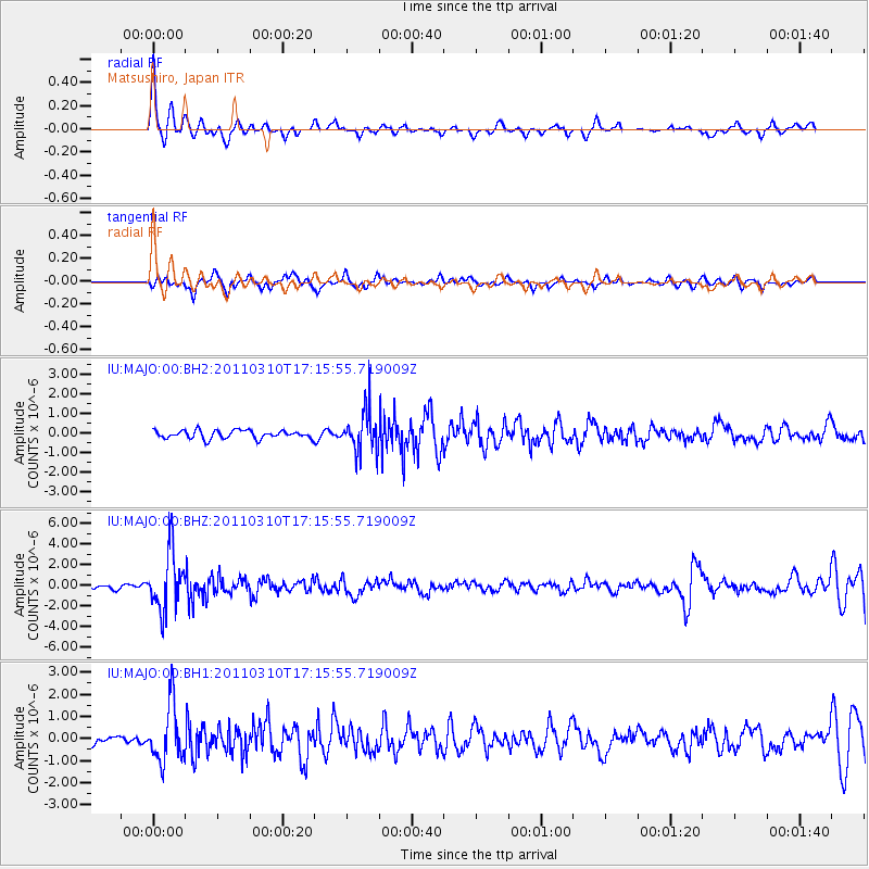
Bali Sea |
| Earthquake latitude/longitude: |
-6.9/116.7 |
| Earthquake time(UTC): |
2011/03/10 (069) 17:08:36 GMT |
| Earthquake Depth: |
511 km |
| Earthquake Magnitude: |
6.6 MW, 6.2 MB, 6.5 MW |
| Earthquake Catalog/Contributor: |
NEIC PDE/NEIC PDE-M |
|
| Network: |
IU Global Seismograph Network (GSN - IRIS/USGS) |
| Station: |
MAJO Matsushiro, Japan |
| Lat/Lon: |
36.55 N/138.20 E |
| Elevation: |
405 m |
|
| Distance: |
47.7 deg |
| Az: |
23.517 deg |
| Baz: |
209.471 deg |
| Ray Param: |
$rayparam |
*The percent match for this event was below the threshold and hence was not used in the summary stack. |
|
| Radial Match: |
73.36846 % |
| Radial Bump: |
309 |
| Transverse Match: |
60.75202 % |
| Transverse Bump: |
381 |
| SOD ConfigId: |
558545 |
| Insert Time: |
2013-09-18 10:38:02.067 +0000 |
| GWidth: |
2.5 |
| Max Bumps: |
400 |
| Tol: |
0.001 |
|
Signal To Noise
| Channel | StoN | STA | LTA |
| IU:MAJO:00:BHZ:20110310T17:15:55.719009Z | 11.4563 | 2.8116394E-6 | 2.45423E-7 |
| IU:MAJO:00:BH1:20110310T17:15:55.719009Z | 3.8409097 | 1.3048686E-6 | 3.3972907E-7 |
| IU:MAJO:00:BH2:20110310T17:15:55.719009Z | 5.2145166 | 1.0884581E-6 | 2.0873617E-7 |
| Arrivals |
| Ps | |
| PpPs | |
| PsPs/PpSs | |


