KAPI Kappang, Sulawesi, Indonesia - Earthquake Result Viewer
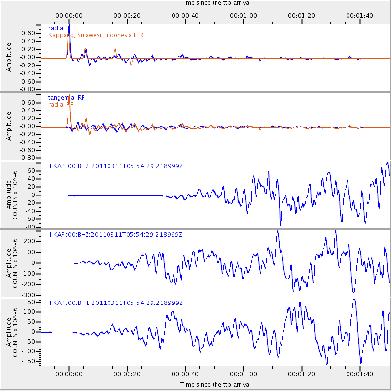
Earthquake location: Near East Coast Of Honshu, Japan
Earthquake latitude/longitude: 38.3/142.4
Earthquake time(UTC): 2011/03/11 (070) 05:46:24 GMT
Earthquake Depth: 29 km
Earthquake Magnitude: 9.0 MW, 7.2 MB, 8.3 MS, 9.0 MW
Earthquake Catalog/Contributor: NEIC PDE/NEIC PDE-M
Network: II Global Seismograph Network (GSN - IRIS/IDA)
Station: KAPI Kappang, Sulawesi, Indonesia
Lat/Lon: 5.01 S/119.75 E
Elevation: 300 m
Distance: 47.9 deg
Az: 211.074 deg
Baz: 24.058 deg
Ray Param: 0.06962571
Estimated Moho Depth: 30.5 km
Estimated Crust Vp/Vs: 2.10
Assumed Crust Vp: 6.343 km/s
Estimated Crust Vs: 3.024 km/s
Estimated Crust Poisson's Ratio: 0.35
Radial Match: 96.095184 %
Radial Bump: 364
Transverse Match: 90.797134 %
Transverse Bump: 400
SOD ConfigId: 558545
Insert Time: 2013-09-18 10:40:05.572 +0000
GWidth: 2.5
Max Bumps: 400
Tol: 0.001

Signal To Noise

ChannelStoNSTALTA
II:KAPI:00:BHZ:20110311T05:54:29.218999Z5.0207087.468012E-61.487442E-6
II:KAPI:00:BH1:20110311T05:54:29.218999Z9.4253983.947622E-64.1882822E-7
II:KAPI:00:BH2:20110311T05:54:29.218999Z8.5877751.6918665E-61.970087E-7
Arrivals
Ps5.5 SECOND
PpPs14 SECOND
PsPs/PpSs20 SECOND