KURK Kurchatov, Kazakhstan - Earthquake Result Viewer
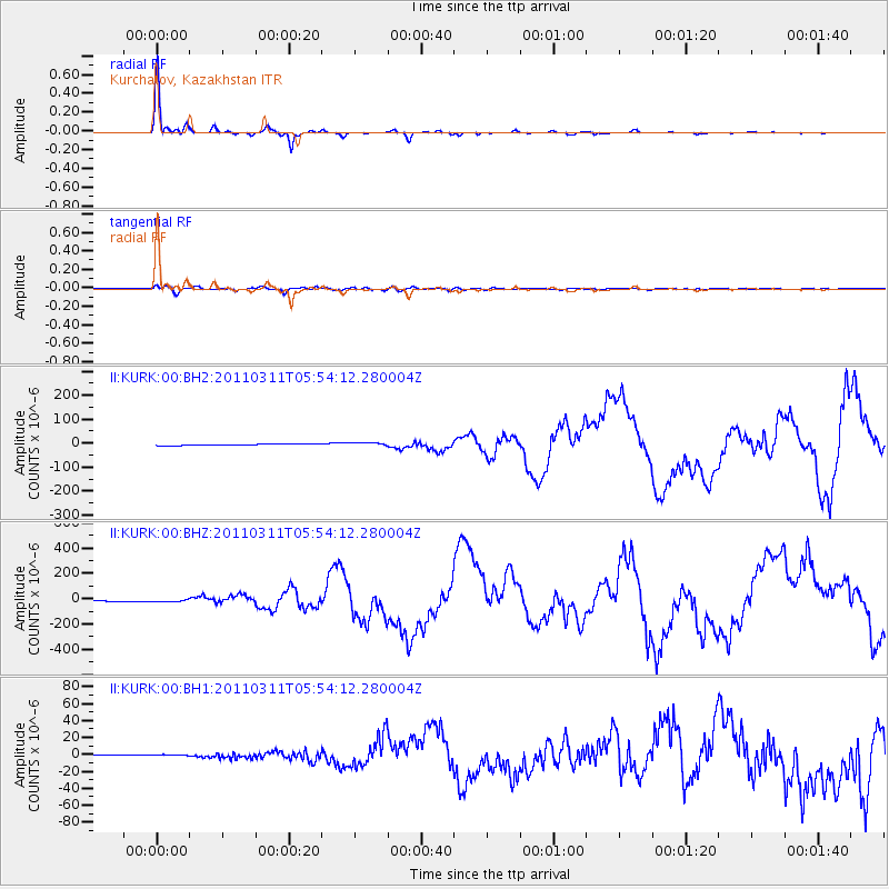
Earthquake location: Near East Coast Of Honshu, Japan
Earthquake latitude/longitude: 38.3/142.4
Earthquake time(UTC): 2011/03/11 (070) 05:46:24 GMT
Earthquake Depth: 29 km
Earthquake Magnitude: 9.0 MW, 7.2 MB, 8.3 MS, 9.0 MW
Earthquake Catalog/Contributor: NEIC PDE/NEIC PDE-M
Network: II Global Seismograph Network (GSN - IRIS/IDA)
Station: KURK Kurchatov, Kazakhstan
Lat/Lon: 50.72 N/78.62 E
Elevation: 184 m
Distance: 45.8 deg
Az: 307.268 deg
Baz: 80.054 deg
Ray Param: 0.07101048
Estimated Moho Depth: 43.5 km
Estimated Crust Vp/Vs: 1.61
Assumed Crust Vp: 6.552 km/s
Estimated Crust Vs: 4.083 km/s
Estimated Crust Poisson's Ratio: 0.18
Radial Match: 99.15767 %
Radial Bump: 164
Transverse Match: 88.26091 %
Transverse Bump: 400
SOD ConfigId: 558545
Insert Time: 2013-09-18 10:40:06.315 +0000
GWidth: 2.5
Max Bumps: 400
Tol: 0.001

Signal To Noise

ChannelStoNSTALTA
II:KURK:00:BHZ:20110311T05:54:12.280004Z1.96005769.971128E-65.087161E-6
II:KURK:00:BH1:20110311T05:54:12.280004Z2.03589531.2096996E-65.9418556E-7
II:KURK:00:BH2:20110311T05:54:12.280004Z2.36096886.891845E-62.9190749E-6
Arrivals
Ps4.3 SECOND
PpPs16 SECOND
PsPs/PpSs20 SECOND