
WRAB Tennant Creek, NT, Australia - Earthquake Result Viewer
| ||||||||||||||||||
| ||||||||||||||||||
| ||||||||||||||||||
|
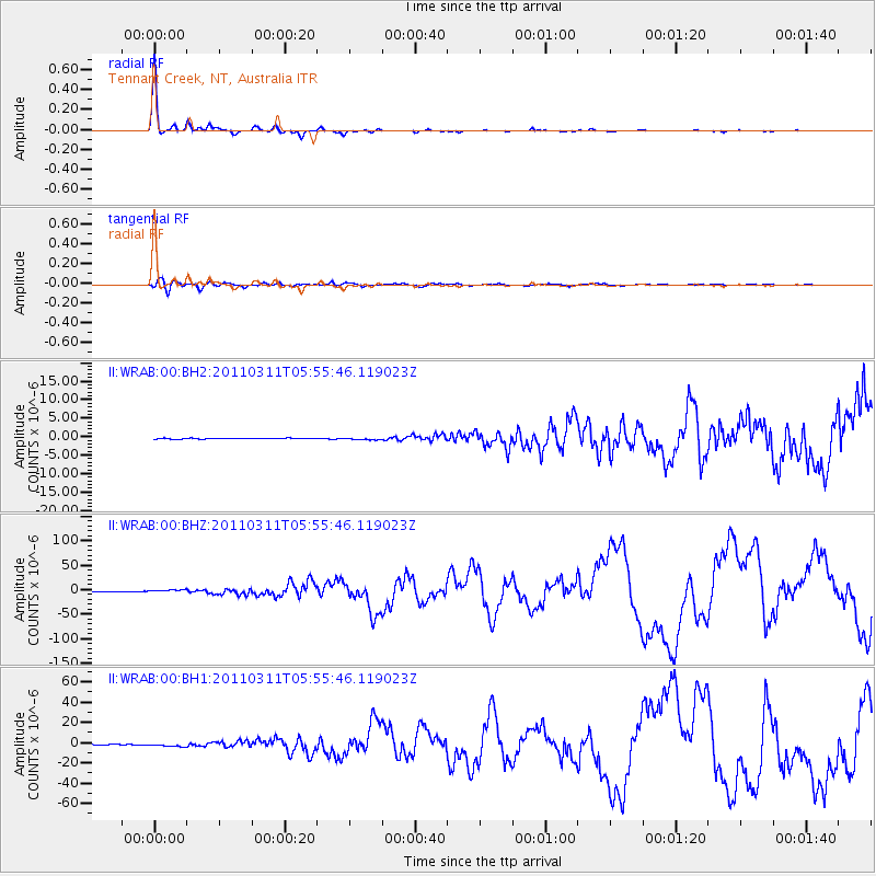
Signal To Noise
| Channel | StoN | STA | LTA |
| II:WRAB:00:BHZ:20110311T05:55:46.119023Z | 17.72813 | 2.7522099E-6 | 1.5524535E-7 |
| II:WRAB:00:BH1:20110311T05:55:46.119023Z | 7.7697825 | 1.5848515E-6 | 2.039763E-7 |
| II:WRAB:00:BH2:20110311T05:55:46.119023Z | 2.139575 | 2.462514E-7 | 1.15093606E-7 |
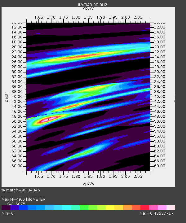
| Arrivals | |
| Ps | 5.4 SECOND |
| PpPs | 19 SECOND |
| PsPs/PpSs | 24 SECOND |

