
ANTO Ankara, Turkey - Earthquake Result Viewer
| ||||||||||||||||||
| ||||||||||||||||||
| ||||||||||||||||||
|
Signal To Noise
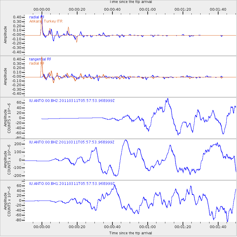
| Channel | StoN | STA | LTA |
| IU:ANTO:00:BHZ:20110311T05:57:53.968999Z | 2.927757 | 6.2451463E-6 | 2.133082E-6 |
| IU:ANTO:00:BH1:20110311T05:57:53.968999Z | 4.482525 | 1.6935654E-6 | 3.7781507E-7 |
| IU:ANTO:00:BH2:20110311T05:57:53.968999Z | 2.5785453 | 2.6282926E-6 | 1.0192927E-6 |
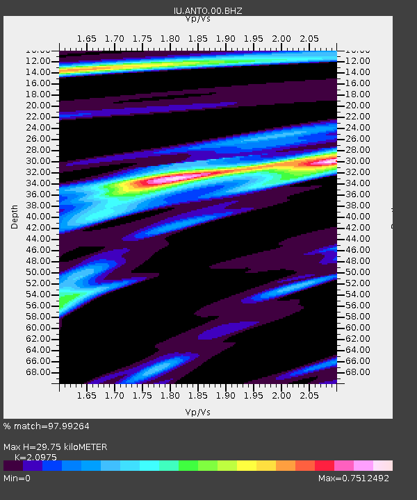
| Arrivals | |
| Ps | 5.4 SECOND |
| PpPs | 15 SECOND |
| PsPs/PpSs | 20 SECOND |

