
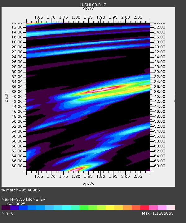
GNI Garni, Armenia - Earthquake Result Viewer
| ||||||||||||||||||
| ||||||||||||||||||
| ||||||||||||||||||
|
Signal To Noise
| Channel | StoN | STA | LTA |
| IU:GNI:00:BHZ:20110311T05:57:11.419011Z | 3.0470164 | 7.5189005E-6 | 2.4676272E-6 |
| IU:GNI:00:BH1:20110311T05:57:11.419011Z | 3.4205709 | 2.2158358E-6 | 6.477971E-7 |
| IU:GNI:00:BH2:20110311T05:57:11.419011Z | 3.7469335 | 3.0931462E-6 | 8.2551406E-7 |
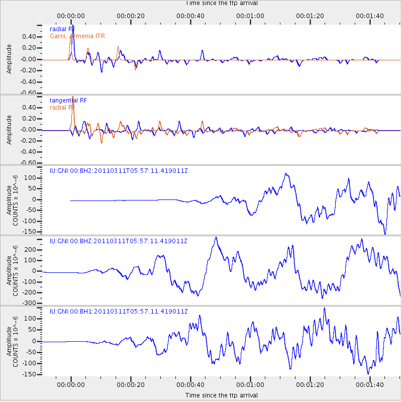
| Arrivals | |
| Ps | 5.5 SECOND |
| PpPs | 17 SECOND |
| PsPs/PpSs | 22 SECOND |

