
HNR Honiara, Solomon Islands - Earthquake Result Viewer
| ||||||||||||||||||
| ||||||||||||||||||
| ||||||||||||||||||
|
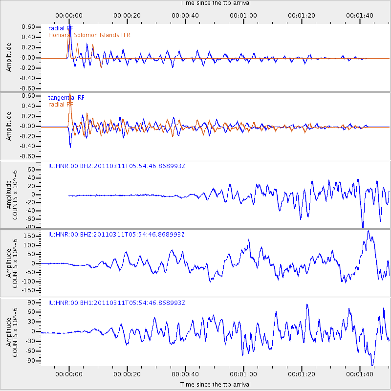
Signal To Noise
| Channel | StoN | STA | LTA |
| IU:HNR:00:BHZ:20110311T05:54:46.868993Z | 3.166124 | 5.914782E-6 | 1.868146E-6 |
| IU:HNR:00:BH1:20110311T05:54:46.868993Z | 2.854557 | 2.1857468E-6 | 7.657044E-7 |
| IU:HNR:00:BH2:20110311T05:54:46.868993Z | 2.346748 | 1.6545624E-6 | 7.050447E-7 |
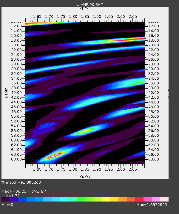
| Arrivals | |
| Ps | 8.2 SECOND |
| PpPs | 28 SECOND |
| PsPs/PpSs | 36 SECOND |

