
PMG Port Moresby, New Guinea - Earthquake Result Viewer
| ||||||||||||||||||
| ||||||||||||||||||
| ||||||||||||||||||
|
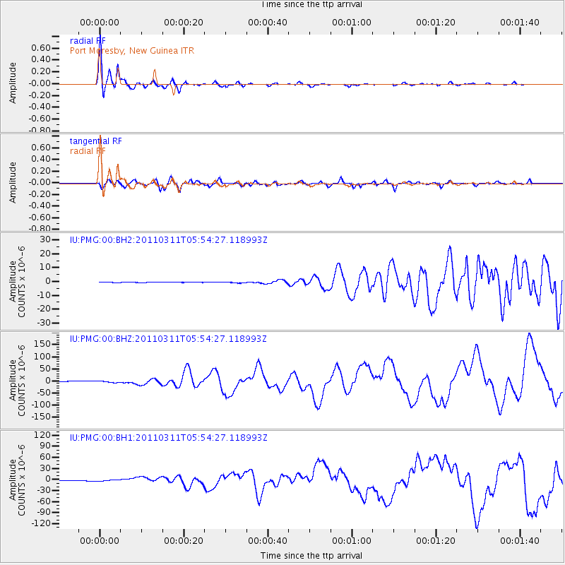
Signal To Noise
| Channel | StoN | STA | LTA |
| IU:PMG:00:BHZ:20110311T05:54:27.118993Z | 3.9954758 | 3.7999025E-6 | 9.5105133E-7 |
| IU:PMG:00:BH1:20110311T05:54:27.118993Z | 3.3737497 | 1.5751845E-6 | 4.668943E-7 |
| IU:PMG:00:BH2:20110311T05:54:27.118993Z | 3.0245392 | 4.1471222E-7 | 1.3711583E-7 |
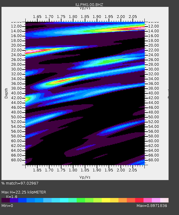
| Arrivals | |
| Ps | 2.3 SECOND |
| PpPs | 8.9 SECOND |
| PsPs/PpSs | 11 SECOND |

