
POHA Pohakuloa, Hawaii, USA - Earthquake Result Viewer
| ||||||||||||||||||
| ||||||||||||||||||
| ||||||||||||||||||
|
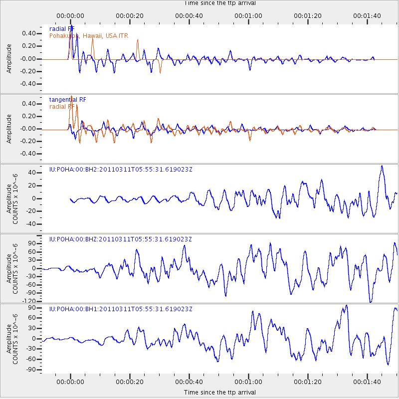
Signal To Noise
| Channel | StoN | STA | LTA |
| IU:POHA:00:BHZ:20110311T05:55:31.619023Z | 3.7867978 | 7.659868E-6 | 2.0227824E-6 |
| IU:POHA:00:BH1:20110311T05:55:31.619023Z | 2.0553224 | 5.59297E-6 | 2.721213E-6 |
| IU:POHA:00:BH2:20110311T05:55:31.619023Z | 1.0001123 | 2.928454E-6 | 2.9281252E-6 |
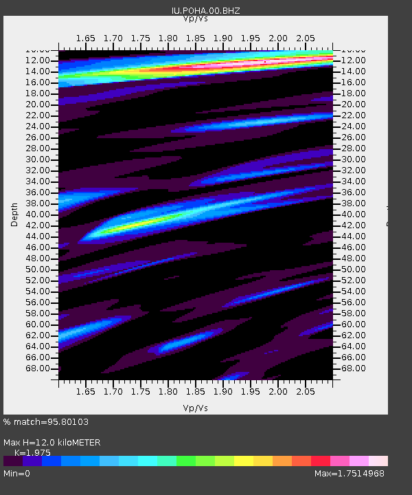
| Arrivals | |
| Ps | 2.3 SECOND |
| PpPs | 6.7 SECOND |
| PsPs/PpSs | 9.0 SECOND |

