
RSSD Black Hills, South Dakota, USA - Earthquake Result Viewer
| ||||||||||||||||||
| ||||||||||||||||||
| ||||||||||||||||||
|
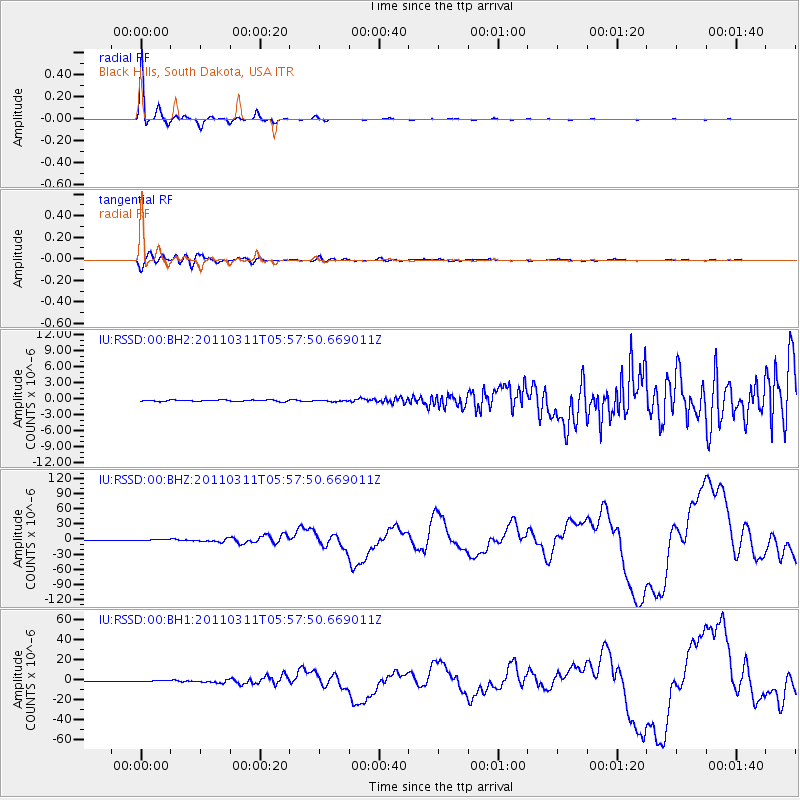
Signal To Noise
| Channel | StoN | STA | LTA |
| IU:RSSD:00:BHZ:20110311T05:57:50.669011Z | 2.4332225 | 9.3990434E-7 | 3.8627965E-7 |
| IU:RSSD:00:BH1:20110311T05:57:50.669011Z | 1.7246011 | 4.2050135E-7 | 2.4382527E-7 |
| IU:RSSD:00:BH2:20110311T05:57:50.669011Z | 0.98217374 | 1.2774416E-7 | 1.3006269E-7 |
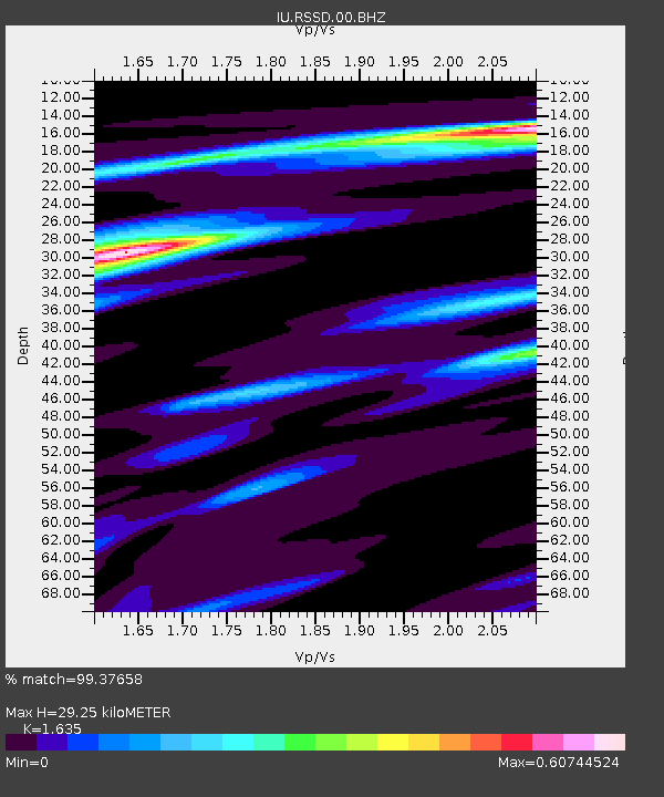
| Arrivals | |
| Ps | 3.1 SECOND |
| PpPs | 12 SECOND |
| PsPs/PpSs | 15 SECOND |

