
KSU1 Kansas State University--Konza Prairie, Kansas, USA - Earthquake Result Viewer
| ||||||||||||||||||
| ||||||||||||||||||
| ||||||||||||||||||
|
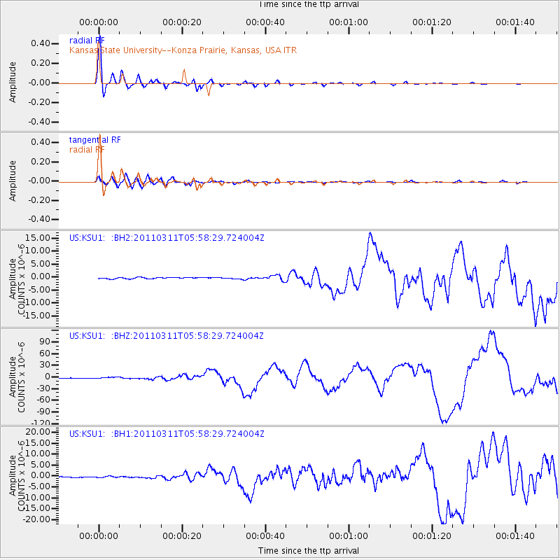
Signal To Noise
| Channel | StoN | STA | LTA |
| US:KSU1: :BHZ:20110311T05:58:29.724004Z | 5.677225 | 1.5746381E-6 | 2.773605E-7 |
| US:KSU1: :BH1:20110311T05:58:29.724004Z | 1.3148029 | 3.065798E-7 | 2.3317547E-7 |
| US:KSU1: :BH2:20110311T05:58:29.724004Z | 1.3500392 | 3.2206603E-7 | 2.3856052E-7 |
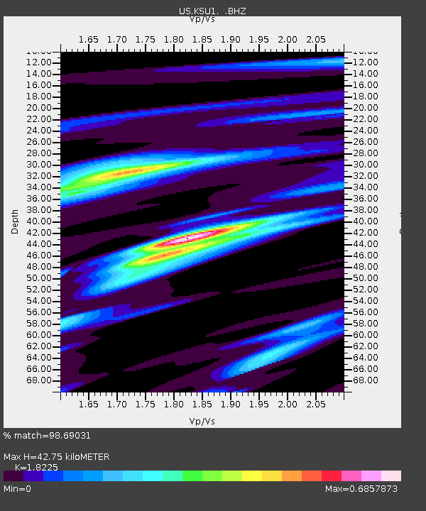
| Arrivals | |
| Ps | 5.6 SECOND |
| PpPs | 18 SECOND |
| PsPs/PpSs | 24 SECOND |

