You are here: Home > Network List > IU - Global Seismograph Network (GSN - IRIS/USGS) Stations List
> Station PMG Port Moresby, New Guinea > Earthquake Result Viewer
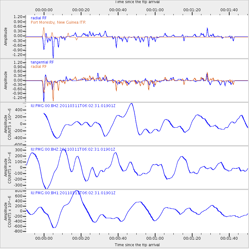
PMG Port Moresby, New Guinea - Earthquake Result Viewer
*The percent match for this event was below the threshold and hence no stack was calculated.
| Earthquake location: |
Near East Coast Of Honshu, Japan |
| Earthquake latitude/longitude: |
37.7/141.2 |
| Earthquake time(UTC): |
2011/03/11 (070) 05:54:31 GMT |
| Earthquake Depth: |
32 km |
| Earthquake Magnitude: |
6.3 MB |
| Earthquake Catalog/Contributor: |
NEIC PDE/NEIC PDE-M |
|
| Network: |
IU Global Seismograph Network (GSN - IRIS/USGS) |
| Station: |
PMG Port Moresby, New Guinea |
| Lat/Lon: |
9.40 S/147.16 E |
| Elevation: |
90 m |
|
| Distance: |
47.2 deg |
| Az: |
171.952 deg |
| Baz: |
353.539 deg |
| Ray Param: |
$rayparam |
*The percent match for this event was below the threshold and hence was not used in the summary stack. |
|
| Radial Match: |
62.909657 % |
| Radial Bump: |
302 |
| Transverse Match: |
57.048203 % |
| Transverse Bump: |
360 |
| SOD ConfigId: |
558545 |
| Insert Time: |
2013-09-18 10:42:23.633 +0000 |
| GWidth: |
2.5 |
| Max Bumps: |
400 |
| Tol: |
0.001 |
|
Signal To Noise
| Channel | StoN | STA | LTA |
| IU:PMG:00:BHZ:20110311T06:02:31.01901Z | 2.3007004 | 2.800229E-4 | 1.2171203E-4 |
| IU:PMG:00:BH1:20110311T06:02:31.01901Z | 1.118321 | 2.7771664E-4 | 2.4833358E-4 |
| IU:PMG:00:BH2:20110311T06:02:31.01901Z | 1.0883404 | 1.8751693E-4 | 1.7229622E-4 |
| Arrivals |
| Ps | |
| PpPs | |
| PsPs/PpSs | |


