You are here: Home > Network List > CI - Caltech Regional Seismic Network Stations List
> Station SLA SLA, Trona, CA, USA > Earthquake Result Viewer
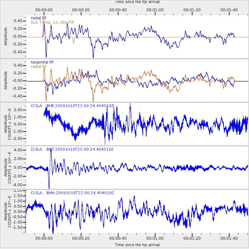
SLA SLA, Trona, CA, USA - Earthquake Result Viewer
*The percent match for this event was below the threshold and hence no stack was calculated.
| Earthquake location: |
Samoa Islands Region |
| Earthquake latitude/longitude: |
-15.4/-172.3 |
| Earthquake time(UTC): |
2009/10/19 (292) 22:49:38 GMT |
| Earthquake Depth: |
18 km |
| Earthquake Magnitude: |
6.2 MB, 5.7 MS, 6.0 MW, 5.9 MW |
| Earthquake Catalog/Contributor: |
WHDF/NEIC |
|
| Network: |
CI Caltech Regional Seismic Network |
| Station: |
SLA SLA, Trona, CA, USA |
| Lat/Lon: |
35.89 N/117.28 W |
| Elevation: |
1174 m |
|
| Distance: |
72.8 deg |
| Az: |
44.12 deg |
| Baz: |
235.803 deg |
| Ray Param: |
$rayparam |
*The percent match for this event was below the threshold and hence was not used in the summary stack. |
|
| Radial Match: |
44.44298 % |
| Radial Bump: |
400 |
| Transverse Match: |
48.914433 % |
| Transverse Bump: |
400 |
| SOD ConfigId: |
2622 |
| Insert Time: |
2010-02-25 20:37:32.136 +0000 |
| GWidth: |
2.5 |
| Max Bumps: |
400 |
| Tol: |
0.001 |
|
Signal To Noise
| Channel | StoN | STA | LTA |
| CI:SLA: :BHZ:20091019T23:00:34.404019Z | 5.9219823 | 1.9546544E-6 | 3.300676E-7 |
| CI:SLA: :BHN:20091019T23:00:34.404019Z | 1.1829356 | 6.4337246E-7 | 5.4387783E-7 |
| CI:SLA: :BHE:20091019T23:00:34.404019Z | 0.905116 | 9.2259785E-7 | 1.0193144E-6 |
| Arrivals |
| Ps | |
| PpPs | |
| PsPs/PpSs | |


