You are here: Home > Network List > IU - Global Seismograph Network (GSN - IRIS/USGS) Stations List
> Station HNR Honiara, Solomon Islands > Earthquake Result Viewer
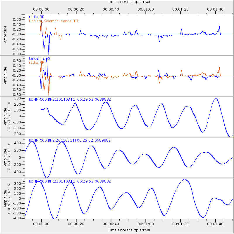
HNR Honiara, Solomon Islands - Earthquake Result Viewer
*The percent match for this event was below the threshold and hence no stack was calculated.
| Earthquake location: |
Near East Coast Of Honshu, Japan |
| Earthquake latitude/longitude: |
38.3/142.8 |
| Earthquake time(UTC): |
2011/03/11 (070) 06:21:32 GMT |
| Earthquake Depth: |
52 km |
| Earthquake Magnitude: |
6.2 MB |
| Earthquake Catalog/Contributor: |
NEIC PDE/NEIC PDE-M |
|
| Network: |
IU Global Seismograph Network (GSN - IRIS/USGS) |
| Station: |
HNR Honiara, Solomon Islands |
| Lat/Lon: |
9.44 S/159.95 E |
| Elevation: |
100 m |
|
| Distance: |
50.1 deg |
| Az: |
157.736 deg |
| Baz: |
342.412 deg |
| Ray Param: |
$rayparam |
*The percent match for this event was below the threshold and hence was not used in the summary stack. |
|
| Radial Match: |
86.676315 % |
| Radial Bump: |
400 |
| Transverse Match: |
80.3483 % |
| Transverse Bump: |
400 |
| SOD ConfigId: |
558545 |
| Insert Time: |
2013-09-18 10:59:46.044 +0000 |
| GWidth: |
2.5 |
| Max Bumps: |
400 |
| Tol: |
0.001 |
|
Signal To Noise
| Channel | StoN | STA | LTA |
| IU:HNR:00:BHZ:20110311T06:29:52.068988Z | 1.4848912 | 4.4204787E-4 | 2.9769714E-4 |
| IU:HNR:00:BH1:20110311T06:29:52.068988Z | 1.0461835 | 2.5552686E-4 | 2.4424668E-4 |
| IU:HNR:00:BH2:20110311T06:29:52.068988Z | 1.2048008 | 1.3263726E-4 | 1.10090616E-4 |
| Arrivals |
| Ps | |
| PpPs | |
| PsPs/PpSs | |


