
FRB IQALUIT, N.W.T. - Earthquake Result Viewer
| ||||||||||||||||||
| ||||||||||||||||||
| ||||||||||||||||||
|
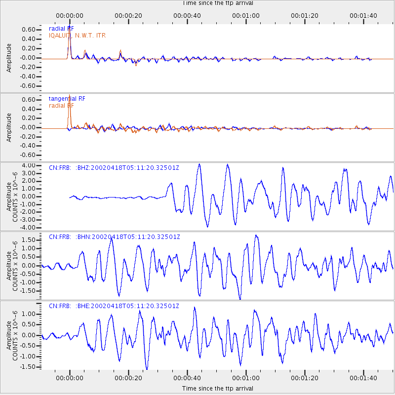
Signal To Noise
| Channel | StoN | STA | LTA |
| CN:FRB: :BHN:20020418T05:11:20.32501Z | 4.913844 | 4.1255612E-7 | 8.395792E-8 |
| CN:FRB: :BHE:20020418T05:11:20.32501Z | 1.7774602 | 2.8265782E-7 | 1.5902343E-7 |
| CN:FRB: :BHZ:20020418T05:11:20.32501Z | 9.014662 | 8.6170303E-7 | 9.558906E-8 |
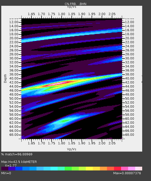
| Arrivals | |
| Ps | 5.4 SECOND |
| PpPs | 17 SECOND |
| PsPs/PpSs | 23 SECOND |

