FRB IQALUIT, N.W.T. - Earthquake Result Viewer
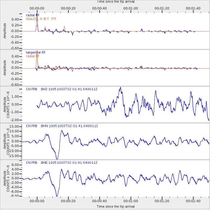
Earthquake location: Peru-Ecuador Border Region
Earthquake latitude/longitude: -2.8/-77.9
Earthquake time(UTC): 1995/10/03 (276) 01:51:24 GMT
Earthquake Depth: 27 km
Earthquake Magnitude: 6.5 MB, 7.0 MS, 6.9 UNKNOWN, 7.0 MW
Earthquake Catalog/Contributor: WHDF/NEIC
Network: CN Canadian National Seismograph Network
Station: FRB IQALUIT, N.W.T.
Lat/Lon: 63.75 N/68.55 W
Elevation: 18 m
Distance: 66.7 deg
Az: 4.505 deg
Baz: 190.162 deg
Ray Param: 0.05739299
Estimated Moho Depth: 41.0 km
Estimated Crust Vp/Vs: 1.82
Assumed Crust Vp: 6.419 km/s
Estimated Crust Vs: 3.522 km/s
Estimated Crust Poisson's Ratio: 0.28
Radial Match: 96.325676 %
Radial Bump: 240
Transverse Match: 79.291214 %
Transverse Bump: 400
SOD ConfigId: 4480
Insert Time: 2010-02-27 05:46:05.963 +0000
GWidth: 2.5
Max Bumps: 400
Tol: 0.001

Signal To Noise

ChannelStoNSTALTA
CN:FRB: :BHN:19951003T02:01:41.649011Z4.0118981.5012444E-63.7419807E-7
CN:FRB: :BHE:19951003T02:01:41.649011Z2.3507078.0960206E-73.4440788E-7
CN:FRB: :BHZ:19951003T02:01:41.649011Z2.34431656.074191E-72.5910288E-7
Arrivals
Ps5.5 SECOND
PpPs17 SECOND
PsPs/PpSs23 SECOND