
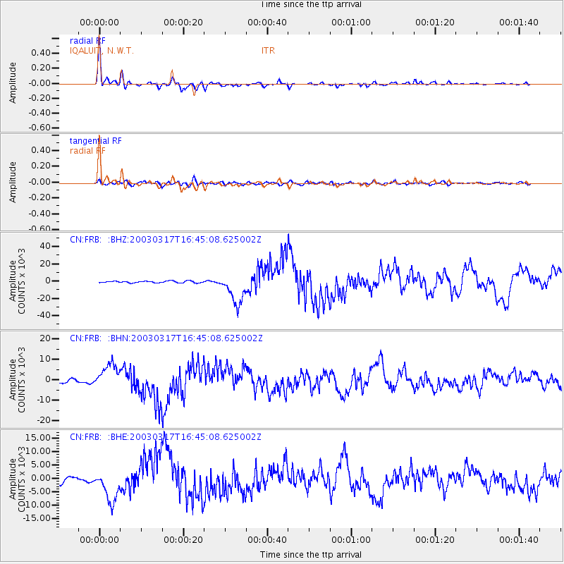
FRB IQALUIT, N.W.T. - Earthquake Result Viewer
| ||||||||||||||||||
| ||||||||||||||||||
| ||||||||||||||||||
|
Signal To Noise
| Channel | StoN | STA | LTA |
| CN:FRB: :BHN:20030317T16:45:08.625002Z | 6.487734 | 6150.3804 | 948.00134 |
| CN:FRB: :BHE:20030317T16:45:08.625002Z | 5.849901 | 6022.577 | 1029.5177 |
| CN:FRB: :BHZ:20030317T16:45:08.625002Z | 18.470213 | 18408.701 | 996.6697 |
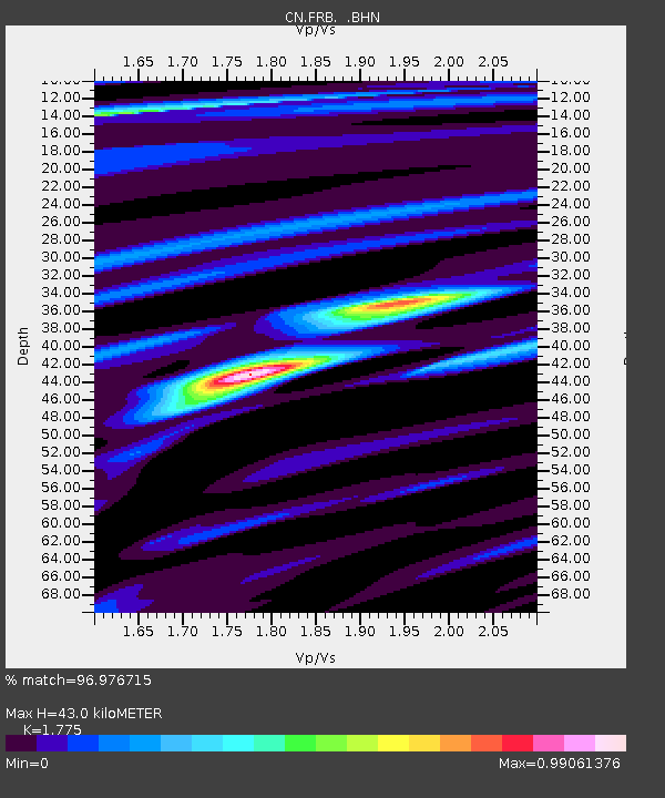
| Arrivals | |
| Ps | 5.5 SECOND |
| PpPs | 18 SECOND |
| PsPs/PpSs | 23 SECOND |

