You are here: Home > Network List > II - Global Seismograph Network (GSN - IRIS/IDA) Stations List
> Station WRAB Tennant Creek, NT, Australia > Earthquake Result Viewer
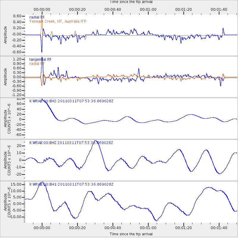
WRAB Tennant Creek, NT, Australia - Earthquake Result Viewer
*The percent match for this event was below the threshold and hence no stack was calculated.
| Earthquake location: |
Near East Coast Of Honshu, Japan |
| Earthquake latitude/longitude: |
36.2/141.8 |
| Earthquake time(UTC): |
2011/03/11 (070) 07:44:27 GMT |
| Earthquake Depth: |
14 km |
| Earthquake Magnitude: |
5.8 MB |
| Earthquake Catalog/Contributor: |
WHDF/NEIC |
|
| Network: |
II Global Seismograph Network (GSN - IRIS/IDA) |
| Station: |
WRAB Tennant Creek, NT, Australia |
| Lat/Lon: |
19.93 S/134.36 E |
| Elevation: |
366 m |
|
| Distance: |
56.3 deg |
| Az: |
188.438 deg |
| Baz: |
7.248 deg |
| Ray Param: |
$rayparam |
*The percent match for this event was below the threshold and hence was not used in the summary stack. |
|
| Radial Match: |
49.16795 % |
| Radial Bump: |
375 |
| Transverse Match: |
56.293453 % |
| Transverse Bump: |
344 |
| SOD ConfigId: |
558545 |
| Insert Time: |
2013-09-18 11:37:45.507 +0000 |
| GWidth: |
2.5 |
| Max Bumps: |
400 |
| Tol: |
0.001 |
|
Signal To Noise
| Channel | StoN | STA | LTA |
| II:WRAB:00:BHZ:20110311T07:53:36.869028Z | 0.30262676 | 2.9742773E-6 | 9.828203E-6 |
| II:WRAB:00:BH1:20110311T07:53:36.869028Z | 2.1266587 | 2.3228067E-5 | 1.092233E-5 |
| II:WRAB:00:BH2:20110311T07:53:36.869028Z | 0.7683799 | 2.0865575E-5 | 2.7155285E-5 |
| Arrivals |
| Ps | |
| PpPs | |
| PsPs/PpSs | |


