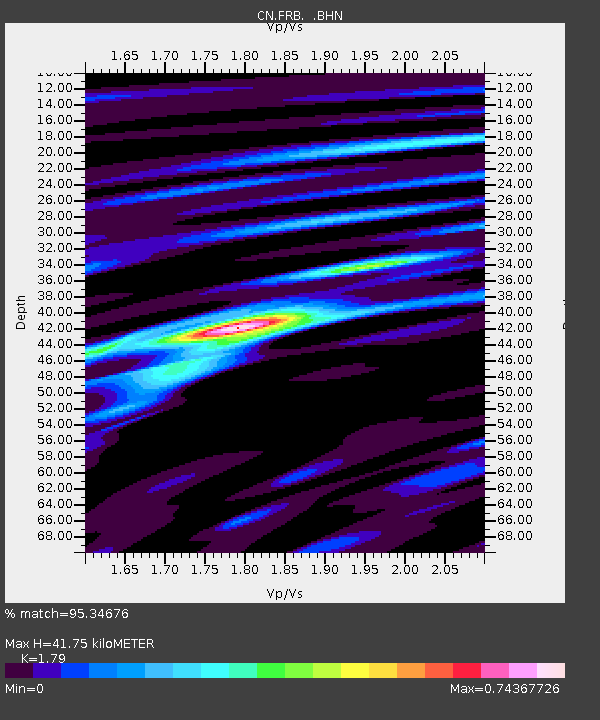
FRB IQALUIT, N.W.T. - Earthquake Result Viewer

Earthquake location: Near S. Coast Of Honshu, Japan
Earthquake latitude/longitude: 33.2/137.2
Earthquake time(UTC): 2004/09/06 (250) 23:29:35 GMT
Earthquake Depth: 10 km
Earthquake Magnitude: 6.4 MB, 6.3 MS, 6.7 MW, 6.5 MW
Earthquake Catalog/Contributor: WHDF/NEIC
Network: CN Canadian National Seismograph Network
Station: FRB IQALUIT, N.W.T.
Lat/Lon: 63.75 N/68.55 W
Elevation: 18 m
Distance: 81.2 deg
Az: 11.284 deg
Baz: 338.355 deg
Ray Param: 0.04773091
Estimated Moho Depth: 41.75 km
Estimated Crust Vp/Vs: 1.79
Assumed Crust Vp: 6.419 km/s
Estimated Crust Vs: 3.586 km/s
Estimated Crust Poisson's Ratio: 0.27
Radial Match: 95.34676 %
Radial Bump: 287
Transverse Match: 84.13289 %
Transverse Bump: 400
SOD ConfigId: 2459
Insert Time: 2010-02-27 05:46:52.057 +0000
GWidth: 2.5
Max Bumps: 400
Tol: 0.001

Signal To Noise

ChannelStoNSTALTA
CN:FRB: :BHN:20040906T23:41:19.699009Z12.5793437402.201588.441
CN:FRB: :BHE:20040906T23:41:19.699009Z3.56382133223.574904.52734
CN:FRB: :BHZ:20040906T23:41:19.699009Z18.25509523993.731314.358
Arrivals
Ps5.3 SECOND
PpPs18 SECOND
PsPs/PpSs23 SECOND