You are here: Home > Network List > IU - Global Seismograph Network (GSN - IRIS/USGS) Stations List
> Station JOHN Johnston Island, USA > Earthquake Result Viewer
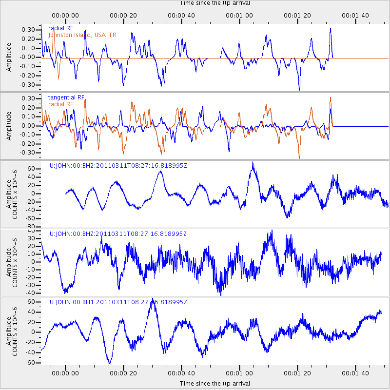
JOHN Johnston Island, USA - Earthquake Result Viewer
*The percent match for this event was below the threshold and hence no stack was calculated.
| Earthquake location: |
Near East Coast Of Honshu, Japan |
| Earthquake latitude/longitude: |
36.2/141.6 |
| Earthquake time(UTC): |
2011/03/11 (070) 08:19:24 GMT |
| Earthquake Depth: |
6.8 km |
| Earthquake Magnitude: |
6.5 MB |
| Earthquake Catalog/Contributor: |
WHDF/NEIC |
|
| Network: |
IU Global Seismograph Network (GSN - IRIS/USGS) |
| Station: |
JOHN Johnston Island, USA |
| Lat/Lon: |
16.73 N/169.53 W |
| Elevation: |
2.0 m |
|
| Distance: |
47.3 deg |
| Az: |
100.855 deg |
| Baz: |
303.964 deg |
| Ray Param: |
$rayparam |
*The percent match for this event was below the threshold and hence was not used in the summary stack. |
|
| Radial Match: |
50.82061 % |
| Radial Bump: |
316 |
| Transverse Match: |
49.057014 % |
| Transverse Bump: |
372 |
| SOD ConfigId: |
558545 |
| Insert Time: |
2013-09-18 11:48:32.926 +0000 |
| GWidth: |
2.5 |
| Max Bumps: |
400 |
| Tol: |
0.001 |
|
Signal To Noise
| Channel | StoN | STA | LTA |
| IU:JOHN:00:BHZ:20110311T08:27:16.818995Z | 2.1051078 | 3.2600925E-5 | 1.5486583E-5 |
| IU:JOHN:00:BH1:20110311T08:27:16.818995Z | 0.87967485 | 1.9411053E-5 | 2.2066168E-5 |
| IU:JOHN:00:BH2:20110311T08:27:16.818995Z | 0.6080028 | 1.5763608E-5 | 2.592687E-5 |
| Arrivals |
| Ps | |
| PpPs | |
| PsPs/PpSs | |


