You are here: Home > Network List > TA - USArray Transportable Network (new EarthScope stations) Stations List
> Station R58B Mineral, VA, USA > Earthquake Result Viewer
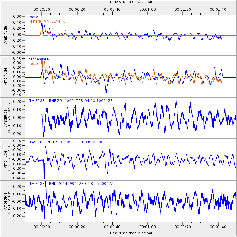
R58B Mineral, VA, USA - Earthquake Result Viewer
*The percent match for this event was below the threshold and hence no stack was calculated.
| Earthquake location: |
Near Coast Of Peru |
| Earthquake latitude/longitude: |
-15.0/-74.9 |
| Earthquake time(UTC): |
2014/09/01 (244) 22:55:20 GMT |
| Earthquake Depth: |
44 km |
| Earthquake Magnitude: |
5.2 MW |
| Earthquake Catalog/Contributor: |
ISC/ISC |
|
| Network: |
TA USArray Transportable Network (new EarthScope stations) |
| Station: |
R58B Mineral, VA, USA |
| Lat/Lon: |
37.96 N/77.88 W |
| Elevation: |
116 m |
|
| Distance: |
52.8 deg |
| Az: |
357.064 deg |
| Baz: |
176.41 deg |
| Ray Param: |
$rayparam |
*The percent match for this event was below the threshold and hence was not used in the summary stack. |
|
| Radial Match: |
54.960014 % |
| Radial Bump: |
400 |
| Transverse Match: |
59.795235 % |
| Transverse Bump: |
400 |
| SOD ConfigId: |
3390531 |
| Insert Time: |
2019-04-13 18:46:53.287 +0000 |
| GWidth: |
2.5 |
| Max Bumps: |
400 |
| Tol: |
0.001 |
|
Signal To Noise
| Channel | StoN | STA | LTA |
| TA:R58B: :BHZ:20140901T23:04:00.500012Z | 1.7707138 | 1.4390628E-7 | 8.127021E-8 |
| TA:R58B: :BHN:20140901T23:04:00.500012Z | 1.7299957 | 1.0259896E-7 | 5.9305904E-8 |
| TA:R58B: :BHE:20140901T23:04:00.500012Z | 0.80572885 | 6.262231E-8 | 7.7721324E-8 |
| Arrivals |
| Ps | |
| PpPs | |
| PsPs/PpSs | |


