You are here: Home > Network List > II - Global Seismograph Network (GSN - IRIS/IDA) Stations List
> Station WRAB Tennant Creek, NT, Australia > Earthquake Result Viewer
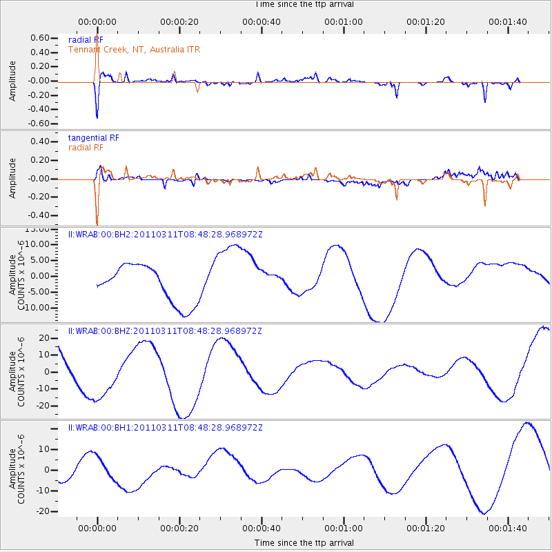
WRAB Tennant Creek, NT, Australia - Earthquake Result Viewer
*The percent match for this event was below the threshold and hence no stack was calculated.
| Earthquake location: |
Off East Coast Of Honshu, Japan |
| Earthquake latitude/longitude: |
37.6/142.8 |
| Earthquake time(UTC): |
2011/03/11 (070) 08:39:12 GMT |
| Earthquake Depth: |
46 km |
| Earthquake Magnitude: |
5.5 MB |
| Earthquake Catalog/Contributor: |
WHDF/NEIC |
|
| Network: |
II Global Seismograph Network (GSN - IRIS/IDA) |
| Station: |
WRAB Tennant Creek, NT, Australia |
| Lat/Lon: |
19.93 S/134.36 E |
| Elevation: |
366 m |
|
| Distance: |
57.8 deg |
| Az: |
189.359 deg |
| Baz: |
7.886 deg |
| Ray Param: |
$rayparam |
*The percent match for this event was below the threshold and hence was not used in the summary stack. |
|
| Radial Match: |
78.47101 % |
| Radial Bump: |
321 |
| Transverse Match: |
67.72031 % |
| Transverse Bump: |
371 |
| SOD ConfigId: |
558545 |
| Insert Time: |
2013-09-18 11:54:35.545 +0000 |
| GWidth: |
2.5 |
| Max Bumps: |
400 |
| Tol: |
0.001 |
|
Signal To Noise
| Channel | StoN | STA | LTA |
| II:WRAB:00:BHZ:20110311T08:48:28.968972Z | 0.95553267 | 1.4246289E-5 | 1.4909264E-5 |
| II:WRAB:00:BH1:20110311T08:48:28.968972Z | 1.1158856 | 5.1246348E-6 | 4.592437E-6 |
| II:WRAB:00:BH2:20110311T08:48:28.968972Z | 1.9422848 | 1.1465059E-5 | 5.902872E-6 |
| Arrivals |
| Ps | |
| PpPs | |
| PsPs/PpSs | |


