You are here: Home > Network List > TA - USArray Transportable Network (new EarthScope stations) Stations List
> Station W57A Gilead, NC, USA > Earthquake Result Viewer
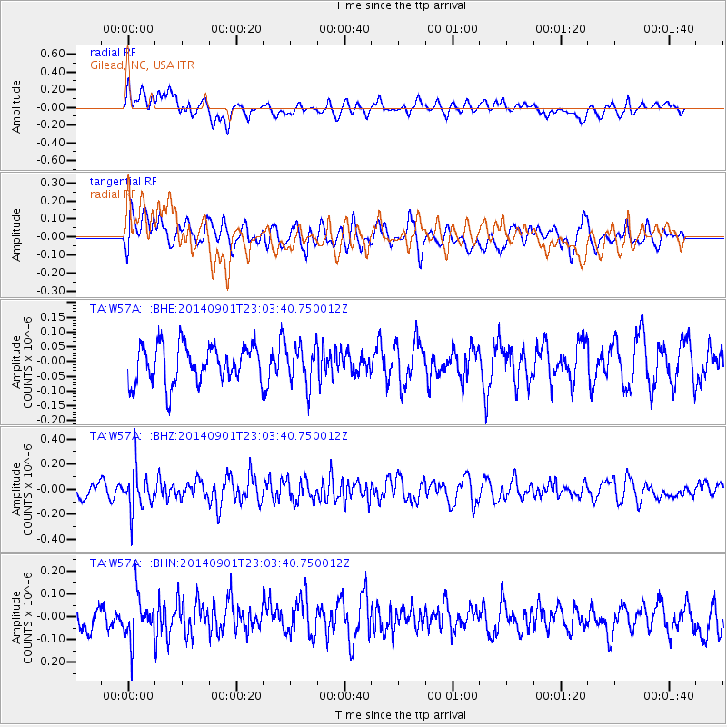
W57A Gilead, NC, USA - Earthquake Result Viewer
*The percent match for this event was below the threshold and hence no stack was calculated.
| Earthquake location: |
Near Coast Of Peru |
| Earthquake latitude/longitude: |
-15.0/-74.9 |
| Earthquake time(UTC): |
2014/09/01 (244) 22:55:20 GMT |
| Earthquake Depth: |
44 km |
| Earthquake Magnitude: |
5.2 MW |
| Earthquake Catalog/Contributor: |
ISC/ISC |
|
| Network: |
TA USArray Transportable Network (new EarthScope stations) |
| Station: |
W57A Gilead, NC, USA |
| Lat/Lon: |
35.15 N/79.99 W |
| Elevation: |
85 m |
|
| Distance: |
50.1 deg |
| Az: |
354.585 deg |
| Baz: |
173.611 deg |
| Ray Param: |
$rayparam |
*The percent match for this event was below the threshold and hence was not used in the summary stack. |
|
| Radial Match: |
61.23494 % |
| Radial Bump: |
400 |
| Transverse Match: |
42.31592 % |
| Transverse Bump: |
400 |
| SOD ConfigId: |
3390531 |
| Insert Time: |
2019-04-13 18:47:05.266 +0000 |
| GWidth: |
2.5 |
| Max Bumps: |
400 |
| Tol: |
0.001 |
|
Signal To Noise
| Channel | StoN | STA | LTA |
| TA:W57A: :BHZ:20140901T23:03:40.750012Z | 3.1704037 | 1.6673204E-7 | 5.259016E-8 |
| TA:W57A: :BHN:20140901T23:03:40.750012Z | 2.095671 | 9.690235E-8 | 4.6239297E-8 |
| TA:W57A: :BHE:20140901T23:03:40.750012Z | 0.97471386 | 6.262016E-8 | 6.424466E-8 |
| Arrivals |
| Ps | |
| PpPs | |
| PsPs/PpSs | |


