FRB IQALUIT, N.W.T. - Earthquake Result Viewer
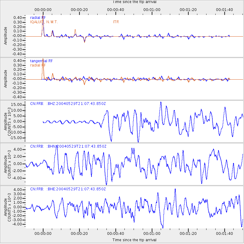
Earthquake location: Off East Coast Of Honshu, Japan
Earthquake latitude/longitude: 34.3/141.4
Earthquake time(UTC): 2004/05/29 (150) 20:56:09 GMT
Earthquake Depth: 16 km
Earthquake Magnitude: 5.6 MB, 6.6 MS, 6.5 MW, 6.3 MW
Earthquake Catalog/Contributor: WHDF/NEIC
Network: CN Canadian National Seismograph Network
Station: FRB IQALUIT, N.W.T.
Lat/Lon: 63.75 N/68.55 W
Elevation: 18 m
Distance: 79.5 deg
Az: 13.053 deg
Baz: 335.125 deg
Ray Param: 0.048921846
Estimated Moho Depth: 41.75 km
Estimated Crust Vp/Vs: 1.79
Assumed Crust Vp: 6.419 km/s
Estimated Crust Vs: 3.586 km/s
Estimated Crust Poisson's Ratio: 0.27
Radial Match: 95.37787 %
Radial Bump: 217
Transverse Match: 77.43075 %
Transverse Bump: 400
SOD ConfigId: 2459
Insert Time: 2010-02-27 05:47:08.697 +0000
GWidth: 2.5
Max Bumps: 400
Tol: 0.001

Signal To Noise

ChannelStoNSTALTA
CN:FRB: :BHN:20040529T21:07:43.850Z2.1137042931.19403440.55078
CN:FRB: :BHE:20040529T21:07:43.850Z1.1122026400.36414359.9741
CN:FRB: :BHZ:20040529T21:07:43.850Z4.540243600.8413793.095
Arrivals
Ps5.3 SECOND
PpPs18 SECOND
PsPs/PpSs23 SECOND