You are here: Home > Network List > IU - Global Seismograph Network (GSN - IRIS/USGS) Stations List
> Station RSSD Black Hills, South Dakota, USA > Earthquake Result Viewer
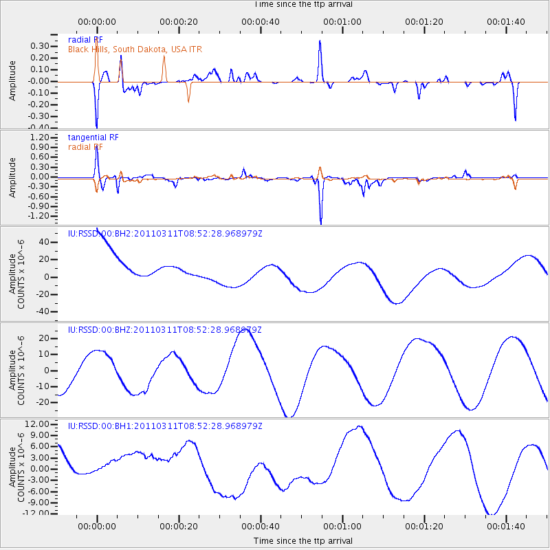
RSSD Black Hills, South Dakota, USA - Earthquake Result Viewer
*The percent match for this event was below the threshold and hence no stack was calculated.
| Earthquake location: |
Eastern Honshu, Japan |
| Earthquake latitude/longitude: |
37.4/141.0 |
| Earthquake time(UTC): |
2011/03/11 (070) 08:40:56 GMT |
| Earthquake Depth: |
40 km |
| Earthquake Magnitude: |
5.9 MB |
| Earthquake Catalog/Contributor: |
WHDF/NEIC |
|
| Network: |
IU Global Seismograph Network (GSN - IRIS/USGS) |
| Station: |
RSSD Black Hills, South Dakota, USA |
| Lat/Lon: |
44.12 N/104.04 W |
| Elevation: |
2090 m |
|
| Distance: |
79.7 deg |
| Az: |
41.561 deg |
| Baz: |
312.85 deg |
| Ray Param: |
$rayparam |
*The percent match for this event was below the threshold and hence was not used in the summary stack. |
|
| Radial Match: |
51.810074 % |
| Radial Bump: |
400 |
| Transverse Match: |
63.59875 % |
| Transverse Bump: |
400 |
| SOD ConfigId: |
558545 |
| Insert Time: |
2013-09-18 11:56:14.007 +0000 |
| GWidth: |
2.5 |
| Max Bumps: |
400 |
| Tol: |
0.001 |
|
Signal To Noise
| Channel | StoN | STA | LTA |
| IU:RSSD:00:BHZ:20110311T08:52:28.968979Z | 1.1673881 | 1.0634744E-5 | 9.109862E-6 |
| IU:RSSD:00:BH1:20110311T08:52:28.968979Z | 0.9117095 | 8.095623E-6 | 8.879609E-6 |
| IU:RSSD:00:BH2:20110311T08:52:28.968979Z | 1.7165368 | 2.4292034E-5 | 1.415177E-5 |
| Arrivals |
| Ps | |
| PpPs | |
| PsPs/PpSs | |


