You are here: Home > Network List > IU - Global Seismograph Network (GSN - IRIS/USGS) Stations List
> Station JOHN Johnston Island, USA > Earthquake Result Viewer
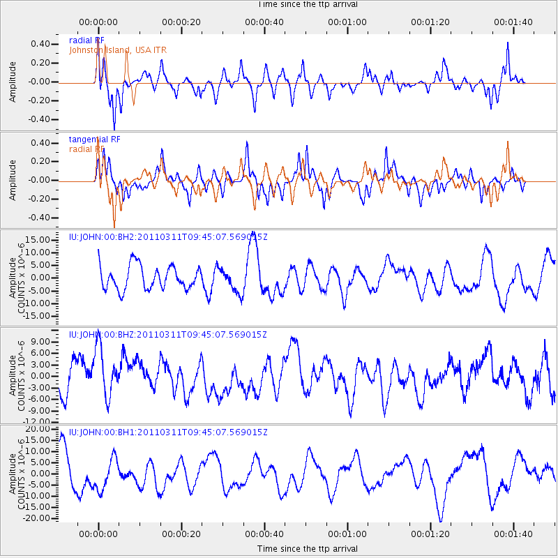
JOHN Johnston Island, USA - Earthquake Result Viewer
*The percent match for this event was below the threshold and hence no stack was calculated.
| Earthquake location: |
Near East Coast Of Honshu, Japan |
| Earthquake latitude/longitude: |
35.9/141.6 |
| Earthquake time(UTC): |
2011/03/11 (070) 09:37:04 GMT |
| Earthquake Depth: |
5.8 km |
| Earthquake Magnitude: |
5.5 MB |
| Earthquake Catalog/Contributor: |
WHDF/NEIC |
|
| Network: |
IU Global Seismograph Network (GSN - IRIS/USGS) |
| Station: |
JOHN Johnston Island, USA |
| Lat/Lon: |
16.73 N/169.53 W |
| Elevation: |
2.0 m |
|
| Distance: |
47.3 deg |
| Az: |
100.654 deg |
| Baz: |
303.633 deg |
| Ray Param: |
$rayparam |
*The percent match for this event was below the threshold and hence was not used in the summary stack. |
|
| Radial Match: |
53.261154 % |
| Radial Bump: |
397 |
| Transverse Match: |
43.275936 % |
| Transverse Bump: |
280 |
| SOD ConfigId: |
558545 |
| Insert Time: |
2013-09-18 12:01:58.386 +0000 |
| GWidth: |
2.5 |
| Max Bumps: |
400 |
| Tol: |
0.001 |
|
Signal To Noise
| Channel | StoN | STA | LTA |
| IU:JOHN:00:BHZ:20110311T09:45:07.569015Z | 1.4843024 | 7.691596E-6 | 5.18196E-6 |
| IU:JOHN:00:BH1:20110311T09:45:07.569015Z | 0.9494071 | 7.3285955E-6 | 7.719129E-6 |
| IU:JOHN:00:BH2:20110311T09:45:07.569015Z | 1.0314583 | 4.6887617E-6 | 4.5457605E-6 |
| Arrivals |
| Ps | |
| PpPs | |
| PsPs/PpSs | |


