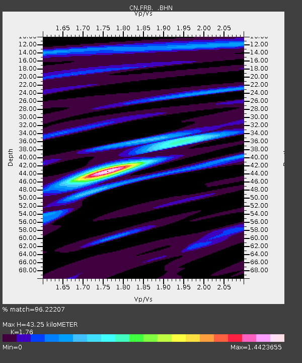
FRB IQALUIT, N.W.T. - Earthquake Result Viewer
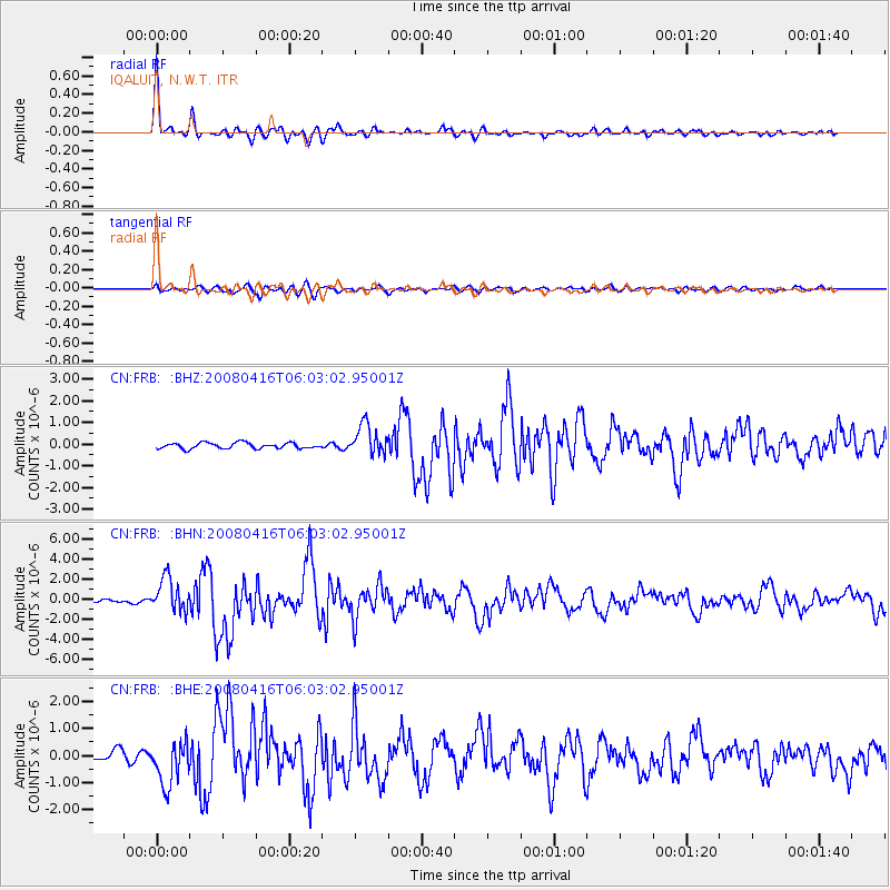
Earthquake location: Andreanof Islands, Aleutian Is.
Earthquake latitude/longitude: 51.9/-179.2
Earthquake time(UTC): 2008/04/16 (107) 05:54:19 GMT
Earthquake Depth: 13 km
Earthquake Magnitude: 6.1 MB, 6.5 MS, 6.6 MW, 6.6 MW
Earthquake Catalog/Contributor: WHDF/NEIC
Network: CN Canadian National Seismograph Network
Station: FRB IQALUIT, N.W.T.
Lat/Lon: 63.75 N/68.55 W
Elevation: 18 m
Distance: 52.7 deg
Az: 31.543 deg
Baz: 313.182 deg
Ray Param: 0.06657247
Estimated Moho Depth: 43.25 km
Estimated Crust Vp/Vs: 1.76
Assumed Crust Vp: 6.419 km/s
Estimated Crust Vs: 3.647 km/s
Estimated Crust Poisson's Ratio: 0.26
Radial Match: 96.22207 %
Radial Bump: 350
Transverse Match: 81.13275 %
Transverse Bump: 400
SOD ConfigId: 2504
Insert Time: 2010-02-27 05:47:39.053 +0000
GWidth: 2.5
Max Bumps: 400
Tol: 0.001

Signal To Noise

ChannelStoNSTALTA
CN:FRB: :BHN:20080416T06:03:02.95001Z12.0580451.6937577E-61.4046702E-7
CN:FRB: :BHE:20080416T06:03:02.95001Z4.36090958.188223E-71.8776412E-7
CN:FRB: :BHZ:20080416T06:03:02.95001Z5.23283246.9320186E-71.3247164E-7
Arrivals
Ps5.4 SECOND
PpPs18 SECOND
PsPs/PpSs23 SECOND