
FRB IQALUIT, N.W.T. - Earthquake Result Viewer
| ||||||||||||||||||
| ||||||||||||||||||
| ||||||||||||||||||
|
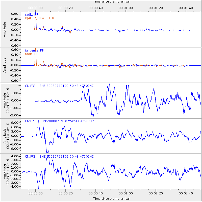
Signal To Noise
| Channel | StoN | STA | LTA |
| CN:FRB: :BHN:20080719T02:50:43.475024Z | 58.200043 | 4.2851284E-6 | 7.362758E-8 |
| CN:FRB: :BHE:20080719T02:50:43.475024Z | 32.905064 | 1.9235902E-6 | 5.8458788E-8 |
| CN:FRB: :BHZ:20080719T02:50:43.475024Z | 10.511172 | 8.7339845E-7 | 8.3092395E-8 |
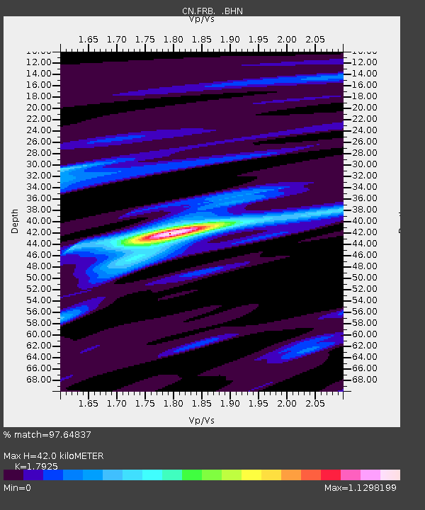
| Arrivals | |
| Ps | 5.3 SECOND |
| PpPs | 18 SECOND |
| PsPs/PpSs | 23 SECOND |

