You are here: Home > Network List > TA - USArray Transportable Network (new EarthScope stations) Stations List
> Station R11A Troy Canyon, Currant, NV, USA > Earthquake Result Viewer
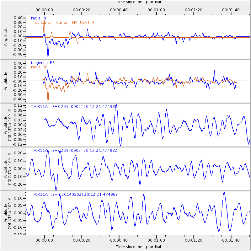
R11A Troy Canyon, Currant, NV, USA - Earthquake Result Viewer
*The percent match for this event was below the threshold and hence no stack was calculated.
| Earthquake location: |
Kermadec Islands Region |
| Earthquake latitude/longitude: |
-28.0/-176.6 |
| Earthquake time(UTC): |
2014/09/02 (245) 20:00:10 GMT |
| Earthquake Depth: |
37 km |
| Earthquake Magnitude: |
5.4 MW |
| Earthquake Catalog/Contributor: |
ISC/ISC |
|
| Network: |
TA USArray Transportable Network (new EarthScope stations) |
| Station: |
R11A Troy Canyon, Currant, NV, USA |
| Lat/Lon: |
38.35 N/115.59 W |
| Elevation: |
1756 m |
|
| Distance: |
87.2 deg |
| Az: |
43.498 deg |
| Baz: |
230.746 deg |
| Ray Param: |
$rayparam |
*The percent match for this event was below the threshold and hence was not used in the summary stack. |
|
| Radial Match: |
61.922802 % |
| Radial Bump: |
400 |
| Transverse Match: |
73.81673 % |
| Transverse Bump: |
400 |
| SOD ConfigId: |
3390531 |
| Insert Time: |
2019-04-13 18:54:20.019 +0000 |
| GWidth: |
2.5 |
| Max Bumps: |
400 |
| Tol: |
0.001 |
|
Signal To Noise
| Channel | StoN | STA | LTA |
| TA:R11A: :BHZ:20140902T20:12:21.47498Z | 1.7784891 | 1.2701469E-7 | 7.141719E-8 |
| TA:R11A: :BHN:20140902T20:12:21.47498Z | 0.92397016 | 5.803009E-8 | 6.280516E-8 |
| TA:R11A: :BHE:20140902T20:12:21.47498Z | 2.0854428 | 5.5693626E-8 | 2.67059E-8 |
| Arrivals |
| Ps | |
| PpPs | |
| PsPs/PpSs | |


