You are here: Home > Network List > GS - US Geological Survey Networks Stations List
> Station KAN10 Keim Farm > Earthquake Result Viewer
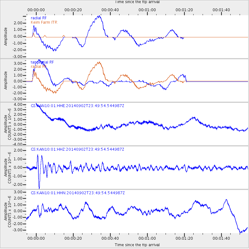
KAN10 Keim Farm - Earthquake Result Viewer
*The percent match for this event was below the threshold and hence no stack was calculated.
| Earthquake location: |
Central East Pacific Rise |
| Earthquake latitude/longitude: |
-11.6/-112.0 |
| Earthquake time(UTC): |
2014/09/02 (245) 23:41:31 GMT |
| Earthquake Depth: |
10 km |
| Earthquake Magnitude: |
5.5 MWP |
| Earthquake Catalog/Contributor: |
NEIC PDE/NEIC COMCAT |
|
| Network: |
GS US Geological Survey Networks |
| Station: |
KAN10 Keim Farm |
| Lat/Lon: |
37.12 N/98.10 W |
| Elevation: |
417 m |
|
| Distance: |
50.2 deg |
| Az: |
14.493 deg |
| Baz: |
197.867 deg |
| Ray Param: |
$rayparam |
*The percent match for this event was below the threshold and hence was not used in the summary stack. |
|
| Radial Match: |
48.063313 % |
| Radial Bump: |
400 |
| Transverse Match: |
40.26127 % |
| Transverse Bump: |
400 |
| SOD ConfigId: |
3390531 |
| Insert Time: |
2019-04-13 18:58:40.867 +0000 |
| GWidth: |
2.5 |
| Max Bumps: |
400 |
| Tol: |
0.001 |
|
Signal To Noise
| Channel | StoN | STA | LTA |
| GS:KAN10:01:HHZ:20140902T23:49:54.544987Z | 10.645061 | 9.986304E-7 | 9.381163E-8 |
| GS:KAN10:01:HHN:20140902T23:49:54.544987Z | 0.6000444 | 5.535688E-7 | 9.2254635E-7 |
| GS:KAN10:01:HHE:20140902T23:49:54.544987Z | 1.2108048 | 1.4945992E-6 | 1.234385E-6 |
| Arrivals |
| Ps | |
| PpPs | |
| PsPs/PpSs | |


