You are here: Home > Network List > II - Global Seismograph Network (GSN - IRIS/IDA) Stations List
> Station TAU Hobart, Tasmania, Australia > Earthquake Result Viewer
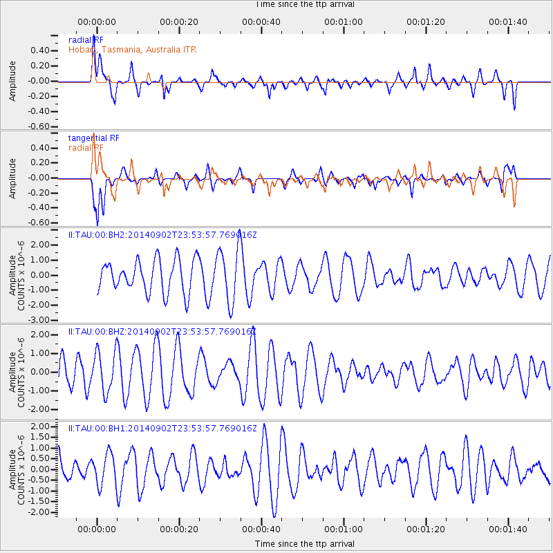
TAU Hobart, Tasmania, Australia - Earthquake Result Viewer
*The percent match for this event was below the threshold and hence no stack was calculated.
| Earthquake location: |
Central East Pacific Rise |
| Earthquake latitude/longitude: |
-11.6/-112.0 |
| Earthquake time(UTC): |
2014/09/02 (245) 23:41:31 GMT |
| Earthquake Depth: |
10 km |
| Earthquake Magnitude: |
5.5 MWP |
| Earthquake Catalog/Contributor: |
NEIC PDE/NEIC COMCAT |
|
| Network: |
II Global Seismograph Network (GSN - IRIS/IDA) |
| Station: |
TAU Hobart, Tasmania, Australia |
| Lat/Lon: |
42.91 S/147.32 E |
| Elevation: |
132 m |
|
| Distance: |
89.9 deg |
| Az: |
226.22 deg |
| Baz: |
105.642 deg |
| Ray Param: |
$rayparam |
*The percent match for this event was below the threshold and hence was not used in the summary stack. |
|
| Radial Match: |
33.181866 % |
| Radial Bump: |
400 |
| Transverse Match: |
72.6302 % |
| Transverse Bump: |
377 |
| SOD ConfigId: |
3390531 |
| Insert Time: |
2019-04-13 18:58:52.548 +0000 |
| GWidth: |
2.5 |
| Max Bumps: |
400 |
| Tol: |
0.001 |
|
Signal To Noise
| Channel | StoN | STA | LTA |
| II:TAU:00:BHZ:20140902T23:53:57.769016Z | 1.3378383 | 1.1193479E-6 | 8.3668397E-7 |
| II:TAU:00:BH1:20140902T23:53:57.769016Z | 0.9214898 | 7.623272E-7 | 8.272769E-7 |
| II:TAU:00:BH2:20140902T23:53:57.769016Z | 1.8085849 | 1.9180586E-6 | 1.0605299E-6 |
| Arrivals |
| Ps | |
| PpPs | |
| PsPs/PpSs | |


