
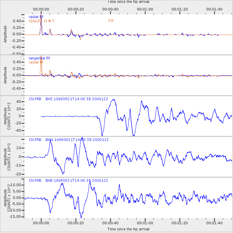
FRB IQALUIT, N.W.T. - Earthquake Result Viewer
| ||||||||||||||||||
| ||||||||||||||||||
| ||||||||||||||||||
|
Signal To Noise
| Channel | StoN | STA | LTA |
| CN:FRB: :BHN:19960621T14:06:38.200012Z | 12.971904 | 3872.0776 | 298.49725 |
| CN:FRB: :BHE:19960621T14:06:38.200012Z | 4.3093386 | 2161.637 | 501.6169 |
| CN:FRB: :BHZ:19960621T14:06:38.200012Z | 22.709885 | 10668.12 | 469.75668 |
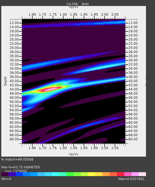
| Arrivals | |
| Ps | 5.3 SECOND |
| PpPs | 18 SECOND |
| PsPs/PpSs | 23 SECOND |

