You are here: Home > Network List > IU - Global Seismograph Network (GSN - IRIS/USGS) Stations List
> Station RSSD Black Hills, South Dakota, USA > Earthquake Result Viewer
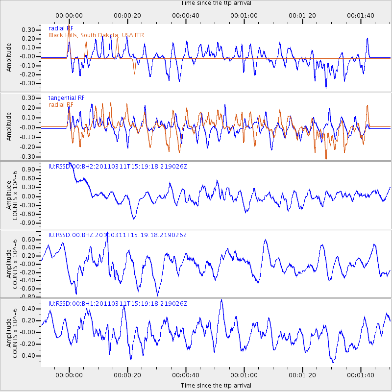
RSSD Black Hills, South Dakota, USA - Earthquake Result Viewer
*The percent match for this event was below the threshold and hence no stack was calculated.
| Earthquake location: |
Near East Coast Of Honshu, Japan |
| Earthquake latitude/longitude: |
36.3/141.5 |
| Earthquake time(UTC): |
2011/03/11 (070) 15:07:39 GMT |
| Earthquake Depth: |
15 km |
| Earthquake Magnitude: |
5.5 MB |
| Earthquake Catalog/Contributor: |
NEIC PDE/NEIC PDE-M |
|
| Network: |
IU Global Seismograph Network (GSN - IRIS/USGS) |
| Station: |
RSSD Black Hills, South Dakota, USA |
| Lat/Lon: |
44.12 N/104.04 W |
| Elevation: |
2090 m |
|
| Distance: |
80.3 deg |
| Az: |
41.705 deg |
| Baz: |
311.761 deg |
| Ray Param: |
$rayparam |
*The percent match for this event was below the threshold and hence was not used in the summary stack. |
|
| Radial Match: |
37.758736 % |
| Radial Bump: |
391 |
| Transverse Match: |
27.841835 % |
| Transverse Bump: |
400 |
| SOD ConfigId: |
558545 |
| Insert Time: |
2013-09-18 12:40:53.423 +0000 |
| GWidth: |
2.5 |
| Max Bumps: |
400 |
| Tol: |
0.001 |
|
Signal To Noise
| Channel | StoN | STA | LTA |
| IU:RSSD:00:BHZ:20110311T15:19:18.219026Z | 1.7503316 | 4.1283786E-7 | 2.3586266E-7 |
| IU:RSSD:00:BH1:20110311T15:19:18.219026Z | 0.5691533 | 1.8150368E-7 | 3.189012E-7 |
| IU:RSSD:00:BH2:20110311T15:19:18.219026Z | 0.4815569 | 1.9876877E-7 | 4.127628E-7 |
| Arrivals |
| Ps | |
| PpPs | |
| PsPs/PpSs | |


