You are here: Home > Network List > II - Global Seismograph Network (GSN - IRIS/IDA) Stations List
> Station PFO Pinon Flat, California, USA > Earthquake Result Viewer
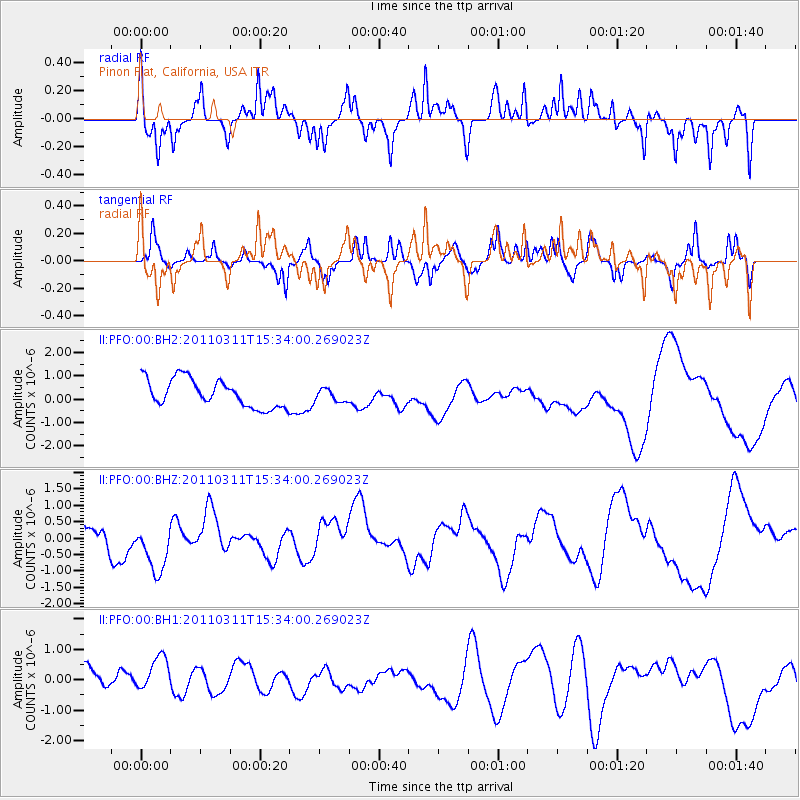
PFO Pinon Flat, California, USA - Earthquake Result Viewer
*The percent match for this event was below the threshold and hence no stack was calculated.
| Earthquake location: |
Near East Coast Of Honshu, Japan |
| Earthquake latitude/longitude: |
35.6/141.5 |
| Earthquake time(UTC): |
2011/03/11 (070) 15:22:27 GMT |
| Earthquake Depth: |
35 km |
| Earthquake Magnitude: |
5.5 MB |
| Earthquake Catalog/Contributor: |
WHDF/NEIC |
|
| Network: |
II Global Seismograph Network (GSN - IRIS/IDA) |
| Station: |
PFO Pinon Flat, California, USA |
| Lat/Lon: |
33.61 N/116.46 W |
| Elevation: |
1280 m |
|
| Distance: |
79.7 deg |
| Az: |
56.057 deg |
| Baz: |
305.928 deg |
| Ray Param: |
$rayparam |
*The percent match for this event was below the threshold and hence was not used in the summary stack. |
|
| Radial Match: |
53.145473 % |
| Radial Bump: |
324 |
| Transverse Match: |
56.362682 % |
| Transverse Bump: |
297 |
| SOD ConfigId: |
558545 |
| Insert Time: |
2013-09-18 12:44:29.652 +0000 |
| GWidth: |
2.5 |
| Max Bumps: |
400 |
| Tol: |
0.001 |
|
Signal To Noise
| Channel | StoN | STA | LTA |
| II:PFO:00:BHZ:20110311T15:34:00.269023Z | 1.8864405 | 8.2167776E-7 | 4.3557046E-7 |
| II:PFO:00:BH1:20110311T15:34:00.269023Z | 1.2666754 | 1.0684302E-6 | 8.4349176E-7 |
| II:PFO:00:BH2:20110311T15:34:00.269023Z | 0.47559732 | 2.8325317E-7 | 5.955735E-7 |
| Arrivals |
| Ps | |
| PpPs | |
| PsPs/PpSs | |


