
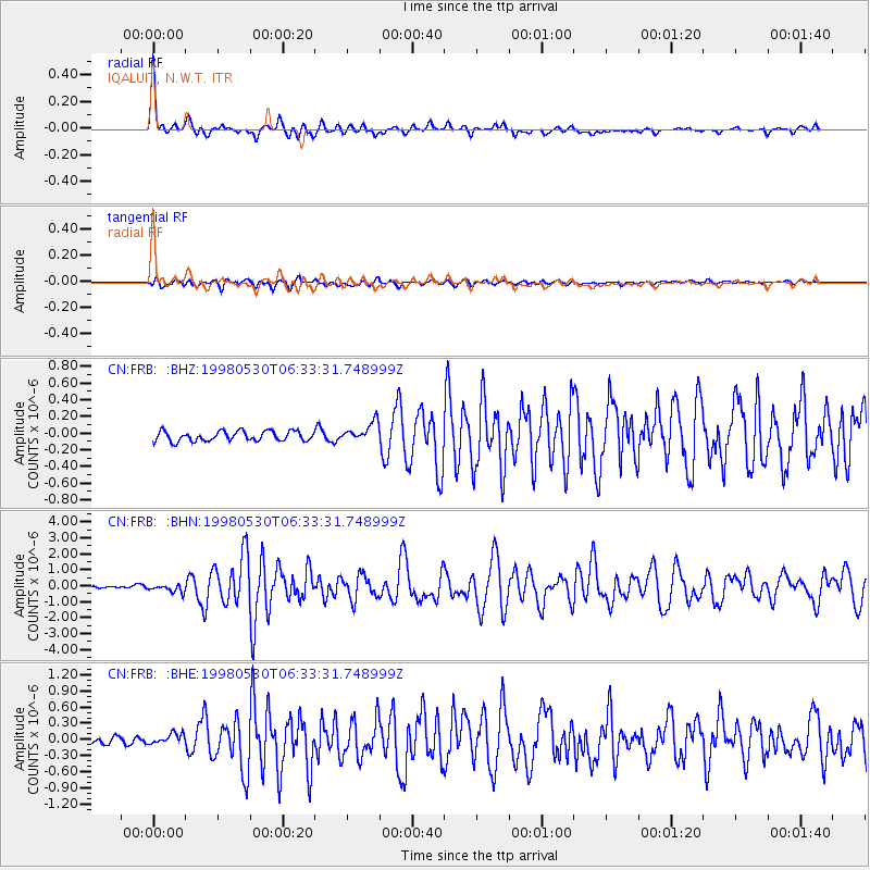
FRB IQALUIT, N.W.T. - Earthquake Result Viewer
| ||||||||||||||||||
| ||||||||||||||||||
| ||||||||||||||||||
|
Signal To Noise
| Channel | StoN | STA | LTA |
| CN:FRB: :BHN:19980530T06:33:31.748999Z | 3.1464224 | 2.3953166E-7 | 7.612825E-8 |
| CN:FRB: :BHE:19980530T06:33:31.748999Z | 1.9265845 | 1.01888645E-7 | 5.288564E-8 |
| CN:FRB: :BHZ:19980530T06:33:31.748999Z | 1.9525471 | 1.15696416E-7 | 5.92541E-8 |
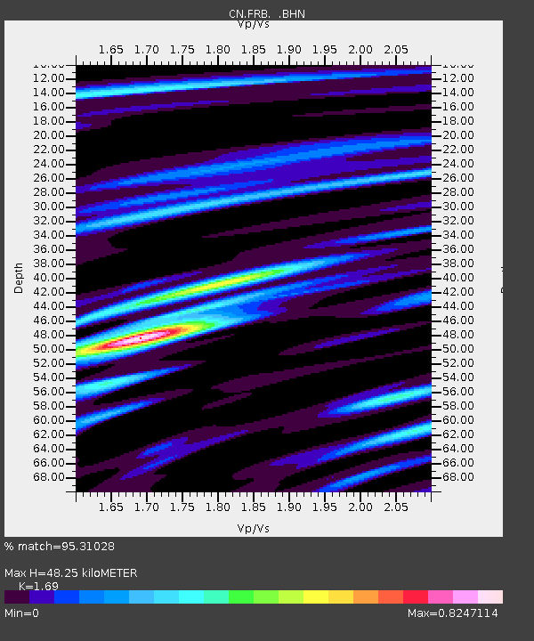
| Arrivals | |
| Ps | 5.4 SECOND |
| PpPs | 20 SECOND |
| PsPs/PpSs | 25 SECOND |

