You are here: Home > Network List > IU - Global Seismograph Network (GSN - IRIS/USGS) Stations List
> Station RSSD Black Hills, South Dakota, USA > Earthquake Result Viewer
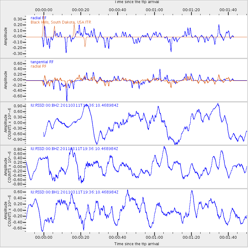
RSSD Black Hills, South Dakota, USA - Earthquake Result Viewer
*The percent match for this event was below the threshold and hence no stack was calculated.
| Earthquake location: |
Near East Coast Of Honshu, Japan |
| Earthquake latitude/longitude: |
35.7/140.7 |
| Earthquake time(UTC): |
2011/03/11 (070) 19:24:24 GMT |
| Earthquake Depth: |
2.2 km |
| Earthquake Magnitude: |
5.5 MB |
| Earthquake Catalog/Contributor: |
WHDF/NEIC |
|
| Network: |
IU Global Seismograph Network (GSN - IRIS/USGS) |
| Station: |
RSSD Black Hills, South Dakota, USA |
| Lat/Lon: |
44.12 N/104.04 W |
| Elevation: |
2090 m |
|
| Distance: |
81.2 deg |
| Az: |
41.206 deg |
| Baz: |
311.871 deg |
| Ray Param: |
$rayparam |
*The percent match for this event was below the threshold and hence was not used in the summary stack. |
|
| Radial Match: |
59.94655 % |
| Radial Bump: |
400 |
| Transverse Match: |
65.927155 % |
| Transverse Bump: |
236 |
| SOD ConfigId: |
558545 |
| Insert Time: |
2013-09-18 12:57:00.769 +0000 |
| GWidth: |
2.5 |
| Max Bumps: |
400 |
| Tol: |
0.001 |
|
Signal To Noise
| Channel | StoN | STA | LTA |
| IU:RSSD:00:BHZ:20110311T19:36:10.468984Z | 0.9489392 | 4.3025753E-7 | 4.5340894E-7 |
| IU:RSSD:00:BH1:20110311T19:36:10.468984Z | 1.9904783 | 4.556407E-7 | 2.2891017E-7 |
| IU:RSSD:00:BH2:20110311T19:36:10.468984Z | 2.169558 | 8.316444E-7 | 3.8332433E-7 |
| Arrivals |
| Ps | |
| PpPs | |
| PsPs/PpSs | |


