You are here: Home > Network List > II - Global Seismograph Network (GSN - IRIS/IDA) Stations List
> Station PFO Pinon Flat, California, USA > Earthquake Result Viewer
PFO Pinon Flat, California, USA - Earthquake Result Viewer
*The percent match for this event was below the threshold and hence no stack was calculated.
| Earthquake location: |
Near East Coast Of Honshu, Japan |
| Earthquake latitude/longitude: |
39.0/142.6 |
| Earthquake time(UTC): |
2011/03/11 (070) 20:11:24 GMT |
| Earthquake Depth: |
17 km |
| Earthquake Magnitude: |
5.9 MB, 5.8 MS, 6.1 MW |
| Earthquake Catalog/Contributor: |
WHDF/NEIC |
|
| Network: |
II Global Seismograph Network (GSN - IRIS/IDA) |
| Station: |
PFO Pinon Flat, California, USA |
| Lat/Lon: |
33.61 N/116.46 W |
| Elevation: |
1280 m |
|
| Distance: |
77.2 deg |
| Az: |
57.189 deg |
| Baz: |
308.307 deg |
| Ray Param: |
$rayparam |
*The percent match for this event was below the threshold and hence was not used in the summary stack. |
|
| Radial Match: |
79.720985 % |
| Radial Bump: |
322 |
| Transverse Match: |
53.835964 % |
| Transverse Bump: |
400 |
| SOD ConfigId: |
558545 |
| Insert Time: |
2013-09-18 12:59:54.247 +0000 |
| GWidth: |
2.5 |
| Max Bumps: |
400 |
| Tol: |
0.001 |
|
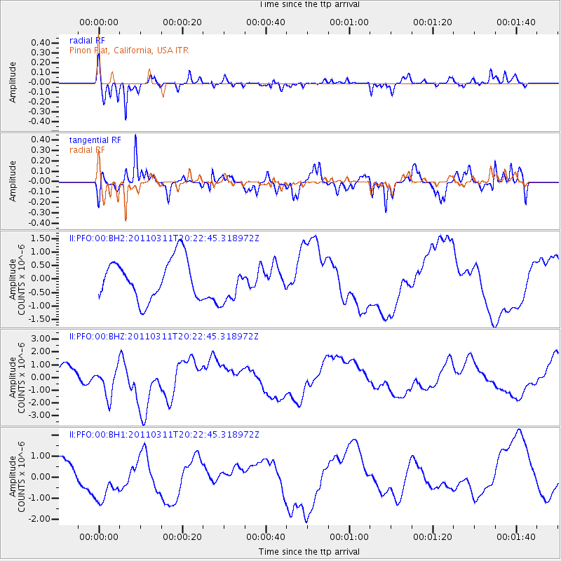
Signal To Noise
| Channel | StoN | STA | LTA |
| II:PFO:00:BHZ:20110311T20:22:45.318972Z | 1.9830678 | 1.4003207E-6 | 7.0613856E-7 |
| II:PFO:00:BH1:20110311T20:22:45.318972Z | 1.1900982 | 1.1973707E-6 | 1.0061109E-6 |
| II:PFO:00:BH2:20110311T20:22:45.318972Z | 0.9262488 | 6.8252604E-7 | 7.368712E-7 |
| Arrivals |
| Ps | |
| PpPs | |
| PsPs/PpSs | |


