You are here: Home > Network List > CN - Canadian National Seismograph Network Stations List
> Station FRB IQALUIT, N.W.T. > Earthquake Result Viewer
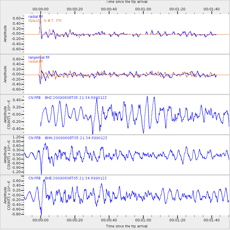
FRB IQALUIT, N.W.T. - Earthquake Result Viewer
*The percent match for this event was below the threshold and hence no stack was calculated.
| Earthquake location: |
Honduras |
| Earthquake latitude/longitude: |
15.8/-86.9 |
| Earthquake time(UTC): |
2009/06/08 (159) 05:13:14 GMT |
| Earthquake Depth: |
10 km |
| Earthquake Magnitude: |
5.5 MB, 4.9 MS, 5.4 MW, 5.4 MW |
| Earthquake Catalog/Contributor: |
WHDF/NEIC |
|
| Network: |
CN Canadian National Seismograph Network |
| Station: |
FRB IQALUIT, N.W.T. |
| Lat/Lon: |
63.75 N/68.55 W |
| Elevation: |
18 m |
|
| Distance: |
49.6 deg |
| Az: |
10.583 deg |
| Baz: |
203.428 deg |
| Ray Param: |
$rayparam |
*The percent match for this event was below the threshold and hence was not used in the summary stack. |
|
| Radial Match: |
55.702564 % |
| Radial Bump: |
400 |
| Transverse Match: |
58.463017 % |
| Transverse Bump: |
400 |
| SOD ConfigId: |
2648 |
| Insert Time: |
2010-02-27 05:51:37.732 +0000 |
| GWidth: |
2.5 |
| Max Bumps: |
400 |
| Tol: |
0.001 |
|
Signal To Noise
| Channel | StoN | STA | LTA |
| CN:FRB: :BHN:20090608T05:21:34.699012Z | 4.6088986 | 5.5626487E-7 | 1.2069366E-7 |
| CN:FRB: :BHE:20090608T05:21:34.699012Z | 3.1786983 | 4.2609608E-7 | 1.3404735E-7 |
| CN:FRB: :BHZ:20090608T05:21:34.699012Z | 1.5565072 | 2.788711E-7 | 1.7916469E-7 |
| Arrivals |
| Ps | |
| PpPs | |
| PsPs/PpSs | |


