You are here: Home > Network List > IU - Global Seismograph Network (GSN - IRIS/USGS) Stations List
> Station RSSD Black Hills, South Dakota, USA > Earthquake Result Viewer
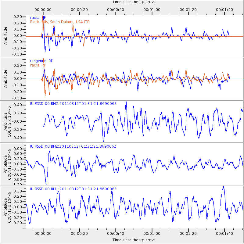
RSSD Black Hills, South Dakota, USA - Earthquake Result Viewer
*The percent match for this event was below the threshold and hence no stack was calculated.
| Earthquake location: |
Tonga Islands |
| Earthquake latitude/longitude: |
-16.7/-173.2 |
| Earthquake time(UTC): |
2011/03/12 (071) 01:19:07 GMT |
| Earthquake Depth: |
14 km |
| Earthquake Magnitude: |
5.7 MB, 6.0 MS, 5.8 MW |
| Earthquake Catalog/Contributor: |
WHDF/NEIC |
|
| Network: |
IU Global Seismograph Network (GSN - IRIS/USGS) |
| Station: |
RSSD Black Hills, South Dakota, USA |
| Lat/Lon: |
44.12 N/104.04 W |
| Elevation: |
2090 m |
|
| Distance: |
87.3 deg |
| Az: |
42.366 deg |
| Baz: |
243.713 deg |
| Ray Param: |
$rayparam |
*The percent match for this event was below the threshold and hence was not used in the summary stack. |
|
| Radial Match: |
68.951385 % |
| Radial Bump: |
400 |
| Transverse Match: |
57.10485 % |
| Transverse Bump: |
400 |
| SOD ConfigId: |
558545 |
| Insert Time: |
2013-09-18 13:06:44.117 +0000 |
| GWidth: |
2.5 |
| Max Bumps: |
400 |
| Tol: |
0.001 |
|
Signal To Noise
| Channel | StoN | STA | LTA |
| IU:RSSD:00:BHZ:20110312T01:31:21.869006Z | 4.46009 | 5.770842E-7 | 1.2938847E-7 |
| IU:RSSD:00:BH1:20110312T01:31:21.869006Z | 0.57113856 | 7.181538E-8 | 1.2574073E-7 |
| IU:RSSD:00:BH2:20110312T01:31:21.869006Z | 1.740605 | 2.126736E-7 | 1.2218372E-7 |
| Arrivals |
| Ps | |
| PpPs | |
| PsPs/PpSs | |


