You are here: Home > Network List > IU - Global Seismograph Network (GSN - IRIS/USGS) Stations List
> Station MAKZ Makanchi, Kazakhstan > Earthquake Result Viewer
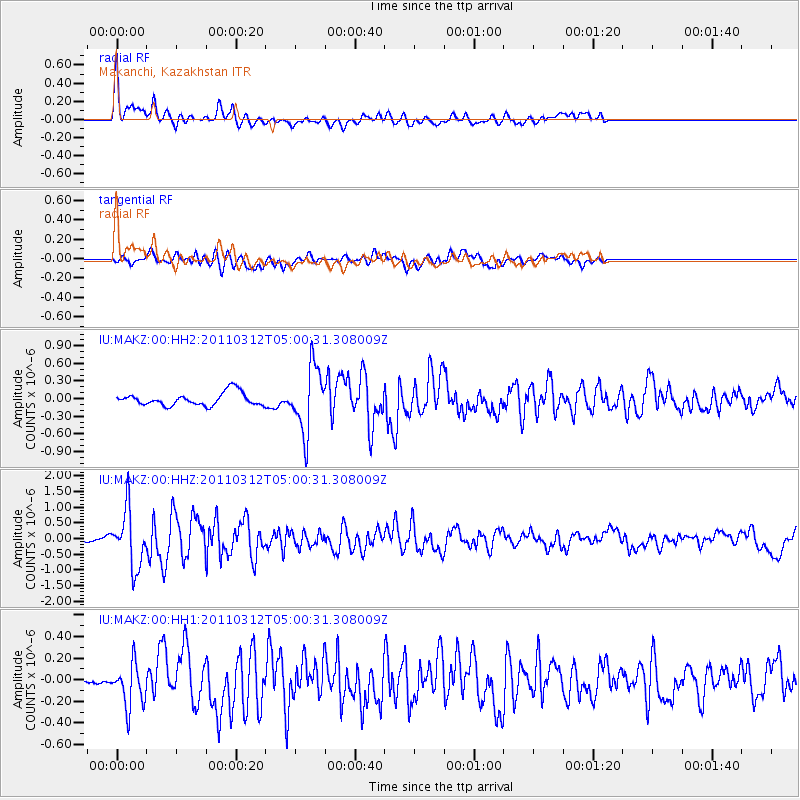
MAKZ Makanchi, Kazakhstan - Earthquake Result Viewer
*The percent match for this event was below the threshold and hence no stack was calculated.
| Earthquake location: |
Off East Coast Of Honshu, Japan |
| Earthquake latitude/longitude: |
40.1/143.2 |
| Earthquake time(UTC): |
2011/03/12 (071) 04:52:57 GMT |
| Earthquake Depth: |
26 km |
| Earthquake Magnitude: |
5.7 MW |
| Earthquake Catalog/Contributor: |
NEIC PDE/NEIC PDE-M |
|
| Network: |
IU Global Seismograph Network (GSN - IRIS/USGS) |
| Station: |
MAKZ Makanchi, Kazakhstan |
| Lat/Lon: |
46.81 N/81.98 E |
| Elevation: |
600 m |
|
| Distance: |
44.0 deg |
| Az: |
299.853 deg |
| Baz: |
75.644 deg |
| Ray Param: |
$rayparam |
*The percent match for this event was below the threshold and hence was not used in the summary stack. |
|
| Radial Match: |
79.83935 % |
| Radial Bump: |
400 |
| Transverse Match: |
73.07888 % |
| Transverse Bump: |
400 |
| SOD ConfigId: |
558545 |
| Insert Time: |
2013-09-18 13:16:15.771 +0000 |
| GWidth: |
2.5 |
| Max Bumps: |
400 |
| Tol: |
0.001 |
|
Signal To Noise
| Channel | StoN | STA | LTA |
| IU:MAKZ:00:HHZ:20110312T05:00:31.308009Z | 7.460538 | 9.1435123E-7 | 1.2255836E-7 |
| IU:MAKZ:00:HH1:20110312T05:00:31.308009Z | 1.9446849 | 2.119656E-7 | 1.089974E-7 |
| IU:MAKZ:00:HH2:20110312T05:00:31.308009Z | 5.1222115 | 5.5203975E-7 | 1.07773715E-7 |
| Arrivals |
| Ps | |
| PpPs | |
| PsPs/PpSs | |


