You are here: Home > Network List > CN - Canadian National Seismograph Network Stations List
> Station FRB IQALUIT, N.W.T. > Earthquake Result Viewer
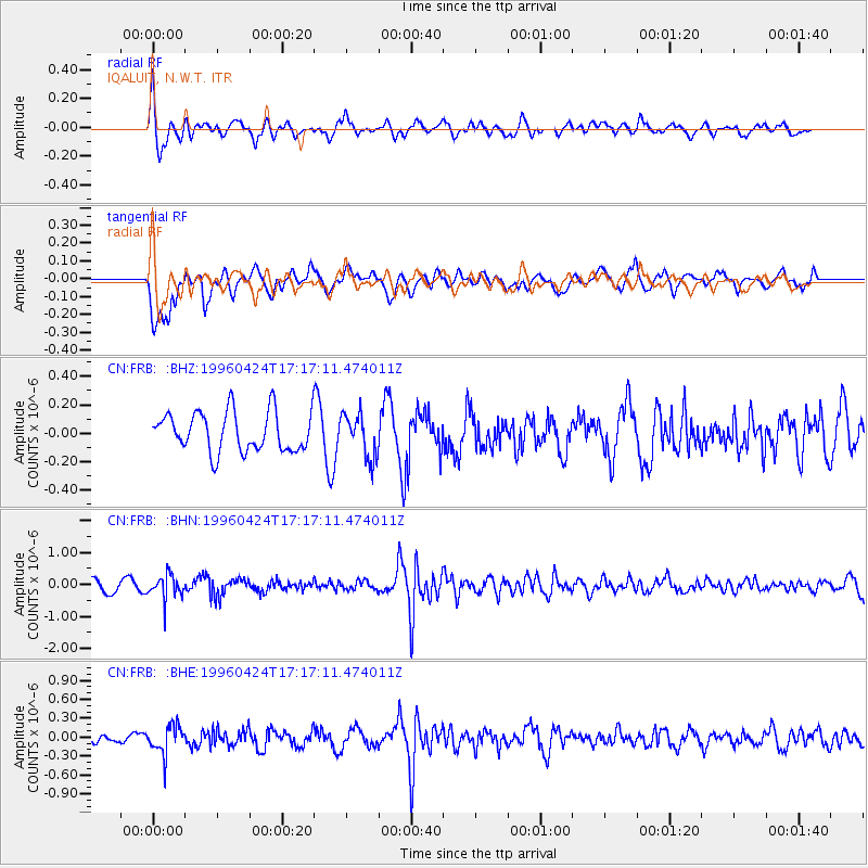
FRB IQALUIT, N.W.T. - Earthquake Result Viewer
*The percent match for this event was below the threshold and hence no stack was calculated.
| Earthquake location: |
Peru-Brazil Border Region |
| Earthquake latitude/longitude: |
-8.1/-74.4 |
| Earthquake time(UTC): |
1996/04/24 (115) 17:06:36 GMT |
| Earthquake Depth: |
151 km |
| Earthquake Magnitude: |
5.6 MB, 5.6 UNKNOWN, 5.6 MW |
| Earthquake Catalog/Contributor: |
WHDF/NEIC |
|
| Network: |
CN Canadian National Seismograph Network |
| Station: |
FRB IQALUIT, N.W.T. |
| Lat/Lon: |
63.75 N/68.55 W |
| Elevation: |
18 m |
|
| Distance: |
71.8 deg |
| Az: |
2.719 deg |
| Baz: |
186.062 deg |
| Ray Param: |
$rayparam |
*The percent match for this event was below the threshold and hence was not used in the summary stack. |
|
| Radial Match: |
69.94283 % |
| Radial Bump: |
400 |
| Transverse Match: |
62.99341 % |
| Transverse Bump: |
400 |
| SOD ConfigId: |
4480 |
| Insert Time: |
2010-02-27 05:52:11.680 +0000 |
| GWidth: |
2.5 |
| Max Bumps: |
400 |
| Tol: |
0.001 |
|
Signal To Noise
| Channel | StoN | STA | LTA |
| CN:FRB: :BHN:19960424T17:17:11.474011Z | 2.2129812 | 3.5738324E-7 | 1.6149403E-7 |
| CN:FRB: :BHE:19960424T17:17:11.474011Z | 2.200693 | 2.217427E-7 | 1.0076041E-7 |
| CN:FRB: :BHZ:19960424T17:17:11.474011Z | 1.1111076 | 1.5379295E-7 | 1.3841411E-7 |
| Arrivals |
| Ps | |
| PpPs | |
| PsPs/PpSs | |


