You are here: Home > Network List > II - Global Seismograph Network (GSN - IRIS/IDA) Stations List
> Station WRAB Tennant Creek, NT, Australia > Earthquake Result Viewer
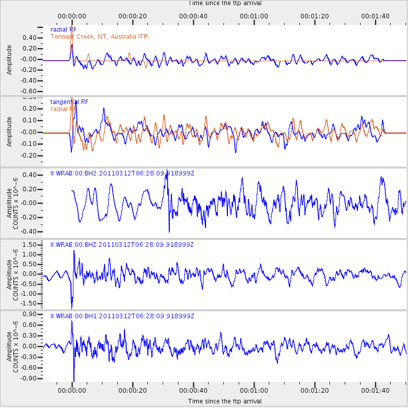
WRAB Tennant Creek, NT, Australia - Earthquake Result Viewer
*The percent match for this event was below the threshold and hence no stack was calculated.
| Earthquake location: |
Near East Coast Of Honshu, Japan |
| Earthquake latitude/longitude: |
39.2/142.3 |
| Earthquake time(UTC): |
2011/03/12 (071) 06:18:44 GMT |
| Earthquake Depth: |
54 km |
| Earthquake Magnitude: |
5.5 MB |
| Earthquake Catalog/Contributor: |
WHDF/NEIC |
|
| Network: |
II Global Seismograph Network (GSN - IRIS/IDA) |
| Station: |
WRAB Tennant Creek, NT, Australia |
| Lat/Lon: |
19.93 S/134.36 E |
| Elevation: |
366 m |
|
| Distance: |
59.3 deg |
| Az: |
188.729 deg |
| Baz: |
7.203 deg |
| Ray Param: |
$rayparam |
*The percent match for this event was below the threshold and hence was not used in the summary stack. |
|
| Radial Match: |
64.60916 % |
| Radial Bump: |
400 |
| Transverse Match: |
64.57968 % |
| Transverse Bump: |
400 |
| SOD ConfigId: |
558545 |
| Insert Time: |
2013-09-18 13:17:06.336 +0000 |
| GWidth: |
2.5 |
| Max Bumps: |
400 |
| Tol: |
0.001 |
|
Signal To Noise
| Channel | StoN | STA | LTA |
| II:WRAB:00:BHZ:20110312T06:28:09.918999Z | 3.943259 | 6.0360117E-7 | 1.5307165E-7 |
| II:WRAB:00:BH1:20110312T06:28:09.918999Z | 2.5523422 | 2.881893E-7 | 1.1291171E-7 |
| II:WRAB:00:BH2:20110312T06:28:09.918999Z | 1.371331 | 2.0532048E-7 | 1.497235E-7 |
| Arrivals |
| Ps | |
| PpPs | |
| PsPs/PpSs | |


