ANTO Ankara, Turkey - Earthquake Result Viewer
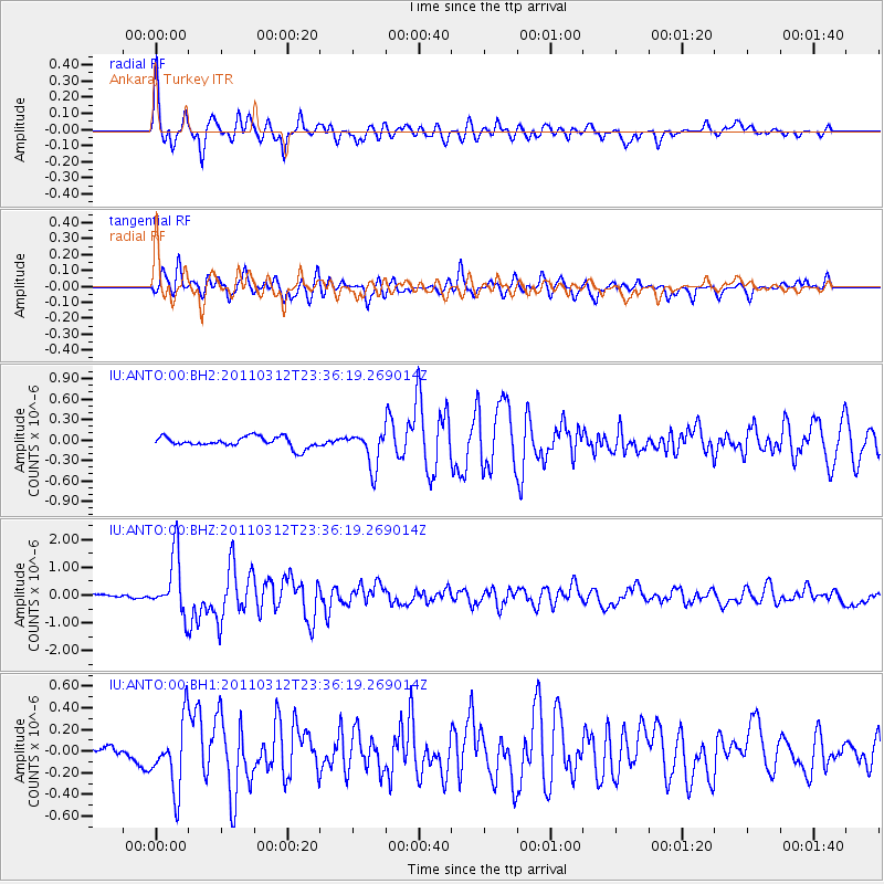
Earthquake location: Near East Coast Of Honshu, Japan
Earthquake latitude/longitude: 38.0/141.7
Earthquake time(UTC): 2011/03/12 (071) 23:24:48 GMT
Earthquake Depth: 15 km
Earthquake Magnitude: 6.0 MB, 5.6 MS, 6.1 MW, 5.9 MW
Earthquake Catalog/Contributor: WHDF/NEIC
Network: IU Global Seismograph Network (GSN - IRIS/USGS)
Station: ANTO Ankara, Turkey
Lat/Lon: 39.87 N/32.79 E
Elevation: 1090 m
Distance: 78.8 deg
Az: 312.077 deg
Baz: 49.588 deg
Ray Param: 0.049408052
Estimated Moho Depth: 31.25 km
Estimated Crust Vp/Vs: 1.85
Assumed Crust Vp: 6.159 km/s
Estimated Crust Vs: 3.329 km/s
Estimated Crust Poisson's Ratio: 0.29
Radial Match: 92.393585 %
Radial Bump: 400
Transverse Match: 85.093735 %
Transverse Bump: 400
SOD ConfigId: 558545
Insert Time: 2013-09-18 13:35:49.801 +0000
GWidth: 2.5
Max Bumps: 400
Tol: 0.001

Signal To Noise

ChannelStoNSTALTA
IU:ANTO:00:BHZ:20110312T23:36:19.269014Z10.6741431.0652993E-69.980185E-8
IU:ANTO:00:BH1:20110312T23:36:19.269014Z4.64170743.1566327E-76.800585E-8
IU:ANTO:00:BH2:20110312T23:36:19.269014Z3.38490492.6408847E-77.801947E-8
Arrivals
Ps4.4 SECOND
PpPs14 SECOND
PsPs/PpSs19 SECOND