
WRAB Tennant Creek, NT, Australia - Earthquake Result Viewer
| ||||||||||||||||||
| ||||||||||||||||||
| ||||||||||||||||||
|
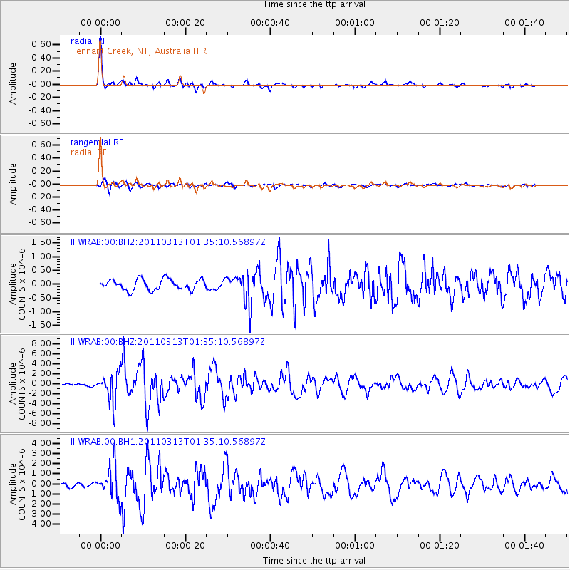
Signal To Noise
| Channel | StoN | STA | LTA |
| II:WRAB:00:BHZ:20110313T01:35:10.56897Z | 15.903516 | 3.0427595E-6 | 1.9132622E-7 |
| II:WRAB:00:BH1:20110313T01:35:10.56897Z | 10.556202 | 1.6196676E-6 | 1.5343281E-7 |
| II:WRAB:00:BH2:20110313T01:35:10.56897Z | 1.6776391 | 3.2317442E-7 | 1.9263642E-7 |
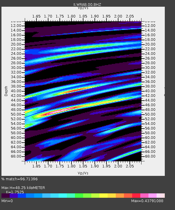
| Arrivals | |
| Ps | 5.8 SECOND |
| PpPs | 19 SECOND |
| PsPs/PpSs | 25 SECOND |

