GNI Garni, Armenia - Earthquake Result Viewer
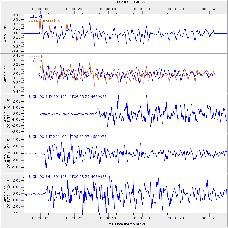
Earthquake location: Off East Coast Of Honshu, Japan
Earthquake latitude/longitude: 37.8/142.5
Earthquake time(UTC): 2011/03/14 (073) 06:12:36 GMT
Earthquake Depth: 14 km
Earthquake Magnitude: 6.0 MW, 5.9 MS, 6.0 MB, 6.0 MW
Earthquake Catalog/Contributor: NEIC PDE/NEIC PDE-M
Network: IU Global Seismograph Network (GSN - IRIS/USGS)
Station: GNI Garni, Armenia
Lat/Lon: 40.15 N/44.74 E
Elevation: 1609 m
Distance: 71.9 deg
Az: 306.964 deg
Baz: 55.68 deg
Ray Param: 0.053996984
Estimated Moho Depth: 10.0 km
Estimated Crust Vp/Vs: 1.60
Assumed Crust Vp: 6.291 km/s
Estimated Crust Vs: 3.932 km/s
Estimated Crust Poisson's Ratio: 0.18
Radial Match: 84.38924 %
Radial Bump: 400
Transverse Match: 82.61821 %
Transverse Bump: 400
SOD ConfigId: 558545
Insert Time: 2013-09-18 13:51:56.486 +0000
GWidth: 2.5
Max Bumps: 400
Tol: 0.001

Signal To Noise

ChannelStoNSTALTA
IU:GNI:00:BHZ:20110314T06:23:27.468997Z25.686971.4768177E-65.7492876E-8
IU:GNI:00:BH1:20110314T06:23:27.468997Z6.9846654.2042421E-76.019247E-8
IU:GNI:00:BH2:20110314T06:23:27.468997Z5.00219733.985962E-77.968423E-8
Arrivals
Ps1.0 SECOND
PpPs4.0 SECOND
PsPs/PpSs5.0 SECOND