You are here: Home > Network List > II - Global Seismograph Network (GSN - IRIS/IDA) Stations List
> Station WRAB Tennant Creek, NT, Australia > Earthquake Result Viewer
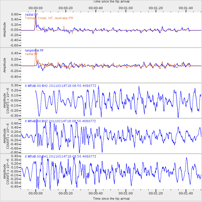
WRAB Tennant Creek, NT, Australia - Earthquake Result Viewer
*The percent match for this event was below the threshold and hence no stack was calculated.
| Earthquake location: |
Off East Coast Of Honshu, Japan |
| Earthquake latitude/longitude: |
37.2/142.2 |
| Earthquake time(UTC): |
2011/03/14 (073) 17:59:41 GMT |
| Earthquake Depth: |
20 km |
| Earthquake Magnitude: |
5.7 MW, 5.4 MS, 5.4 MB, 5.6 MW |
| Earthquake Catalog/Contributor: |
WHDF/NEIC |
|
| Network: |
II Global Seismograph Network (GSN - IRIS/IDA) |
| Station: |
WRAB Tennant Creek, NT, Australia |
| Lat/Lon: |
19.93 S/134.36 E |
| Elevation: |
366 m |
|
| Distance: |
57.3 deg |
| Az: |
188.821 deg |
| Baz: |
7.477 deg |
| Ray Param: |
$rayparam |
*The percent match for this event was below the threshold and hence was not used in the summary stack. |
|
| Radial Match: |
58.691822 % |
| Radial Bump: |
400 |
| Transverse Match: |
58.035892 % |
| Transverse Bump: |
400 |
| SOD ConfigId: |
558545 |
| Insert Time: |
2013-09-18 13:53:11.589 +0000 |
| GWidth: |
2.5 |
| Max Bumps: |
400 |
| Tol: |
0.001 |
|
Signal To Noise
| Channel | StoN | STA | LTA |
| II:WRAB:00:BHZ:20110314T18:08:56.468977Z | 2.7779582 | 3.0498532E-7 | 1.0978758E-7 |
| II:WRAB:00:BH1:20110314T18:08:56.468977Z | 2.0964203 | 2.4674125E-7 | 1.17696466E-7 |
| II:WRAB:00:BH2:20110314T18:08:56.468977Z | 1.0963786 | 1.3738102E-7 | 1.2530437E-7 |
| Arrivals |
| Ps | |
| PpPs | |
| PsPs/PpSs | |


